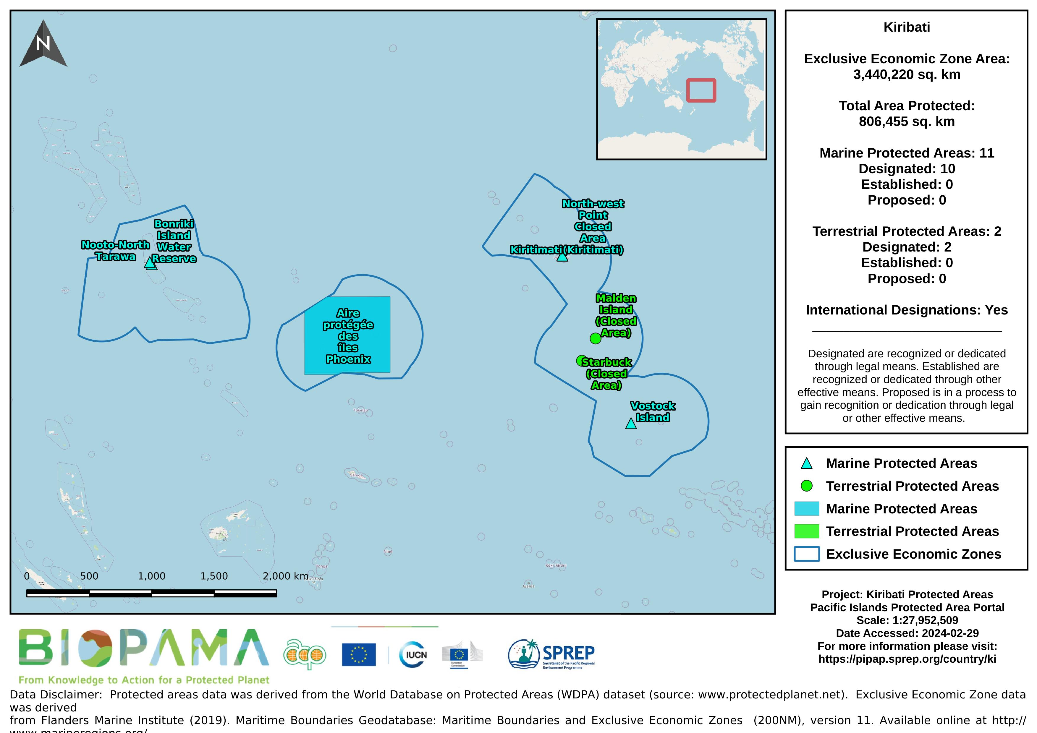
Map of the protected areas for Kiribati with country-level summary statistics on the amount of area under protection, count for each type of protected area (terrestrial or marine), and the count of their designation.
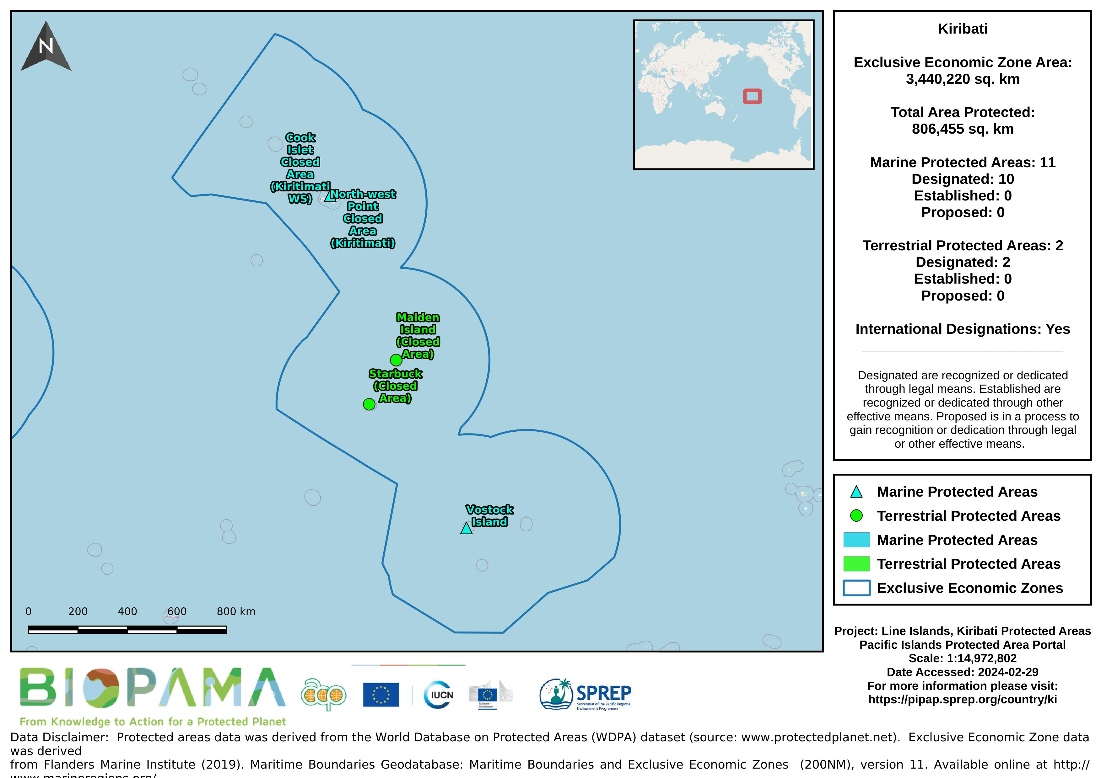
Map of the protected areas for the Line Islands, Kiribati with country-level summary statistics on the amount of area under protection, count for each type of protected area (terrestrial or marine), and the count of their designation.
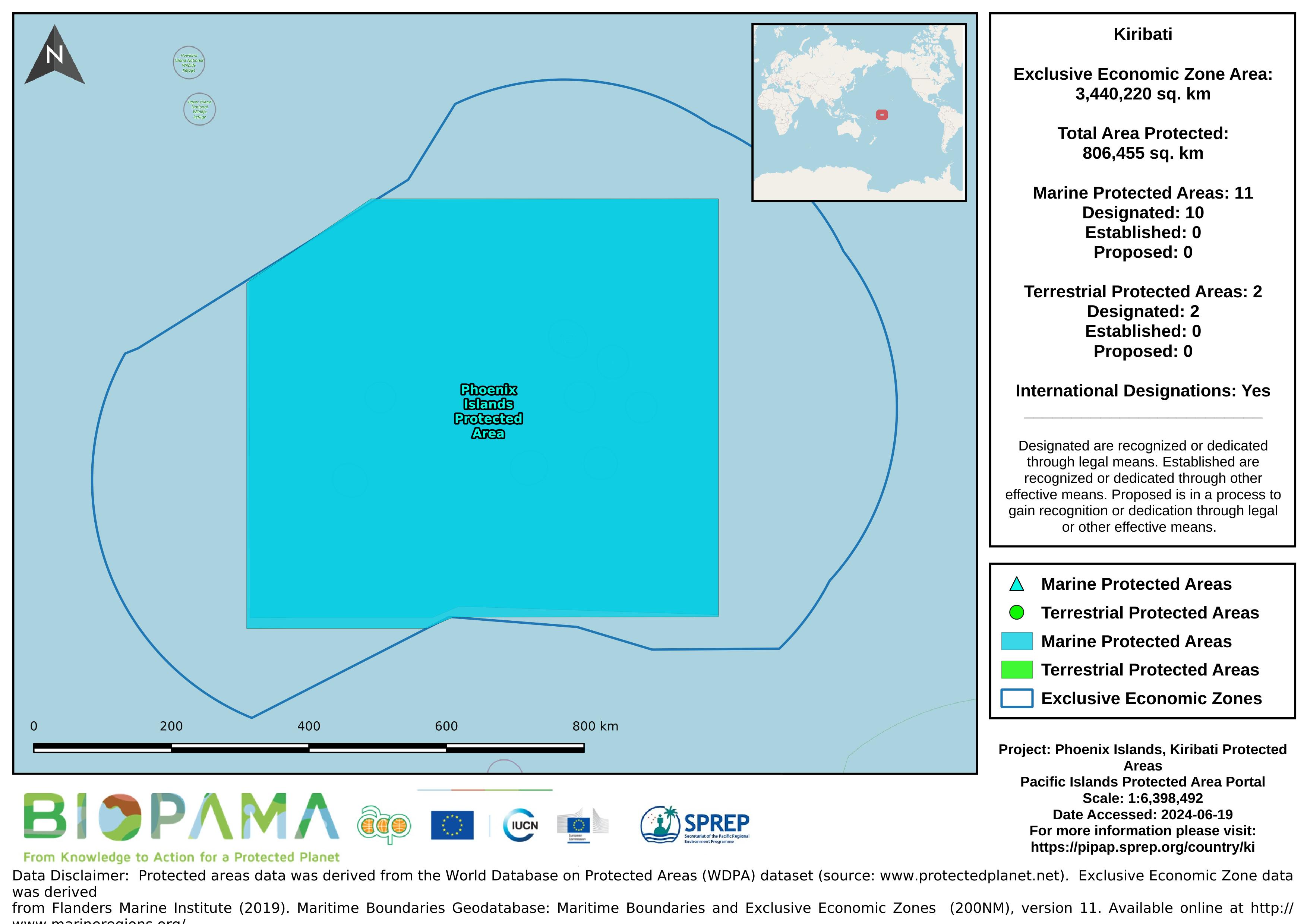
Map of the protected areas for the Phoenix Islands, Kiribati with country-level summary statistics on the amount of area under protection, count for each type of protected area (terrestrial or marine), and the count of their designation.
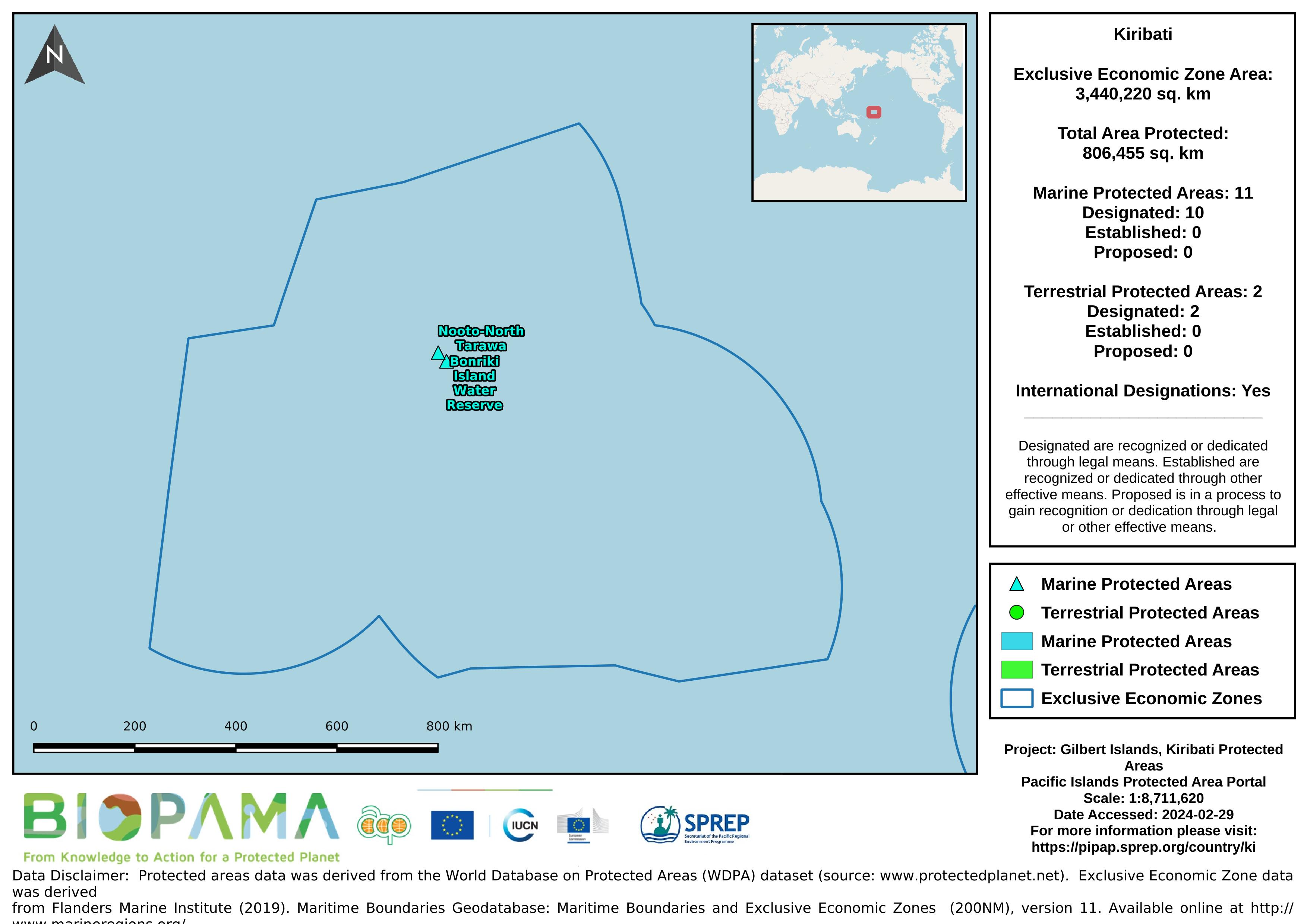
Map of the protected areas for the Gilbert Islands, Kiribati with country-level summary statistics on the amount of area under protection, count for each type of protected area (terrestrial or marine), and the count of their designation.
A direct internet link to access statistics and related info submitted to the UNEP Ozone Secretariat
A direct internet link to access statistics and related info submitted to the UNEP Ozone Secretariat
Data submitted to the UN Ozone Secretariat highlighting the trend of ODS consumption (calculated as Production (if any) + imports - exports) in Kiribati. Ozone Depleting Substances calculated here are HCFCs and Methal Bromide.
This datase provides a direct internet link to access fish species information such as (names, distribution, taxonomy, habitats, behavior, genetic etc) for Kiribati
FishBase is a global species database of fish species (specifically finfish). It is the largest and most extensively accessed online database on adult finfish on the web.
This dataset provides a direct internet link to easily access marine life information and data recorded for Kiribati on the Sea Life Base portal.
Sea Life Base is a global online database of information about marine life. It aims to provide key information on the taxonomy, distribution and ecology of all marine species in the world apart from finfish.
Dataset that provides a direct link to Kiribati's data hosted on the GBIF website/ records.
A direct internet link to Kiribati's Integrated Vulnerability and Adaptation Assessment (KIVA) database - a key instrument to identify and prepare a nation and its people to the risks posed by climate change and disaster.
direct internet link to data related to bird species of Kiribati on the BirdLife International portal
Throughout this paper, the authors have taken a regional approach, pioneered by Weisler (1996), that allowed them to understand the contrasting settlement patterns on two adjacent “mystery islands”. In their view, wet Tabuaeran was the primary locus of settlement, with dry Kiritimati acting as a peripheral base for specialized activities. This analysis challenges the prevailing “mystery island” paradigm which focuses on resource scarcity and isolation.
The World Database on Protected Areas (WDPA) is the most comprehensive global database of marine and terrestrial protected areas, updated on a monthly basis, and is one of the key global biodiversity data sets being widely used by scientists, businesses, governments, International secretariats and others to inform planning, policy decisions and management. The WDPA is a joint project between UN Environment and the International Union for Conservation of Nature (IUCN).
direct link to Kiribati's data on the GBIF records
direct link to all species occurrences in Kiribati on the GBIF records...
This online interactive atlas is complimented by both a hard copy and e-atlas