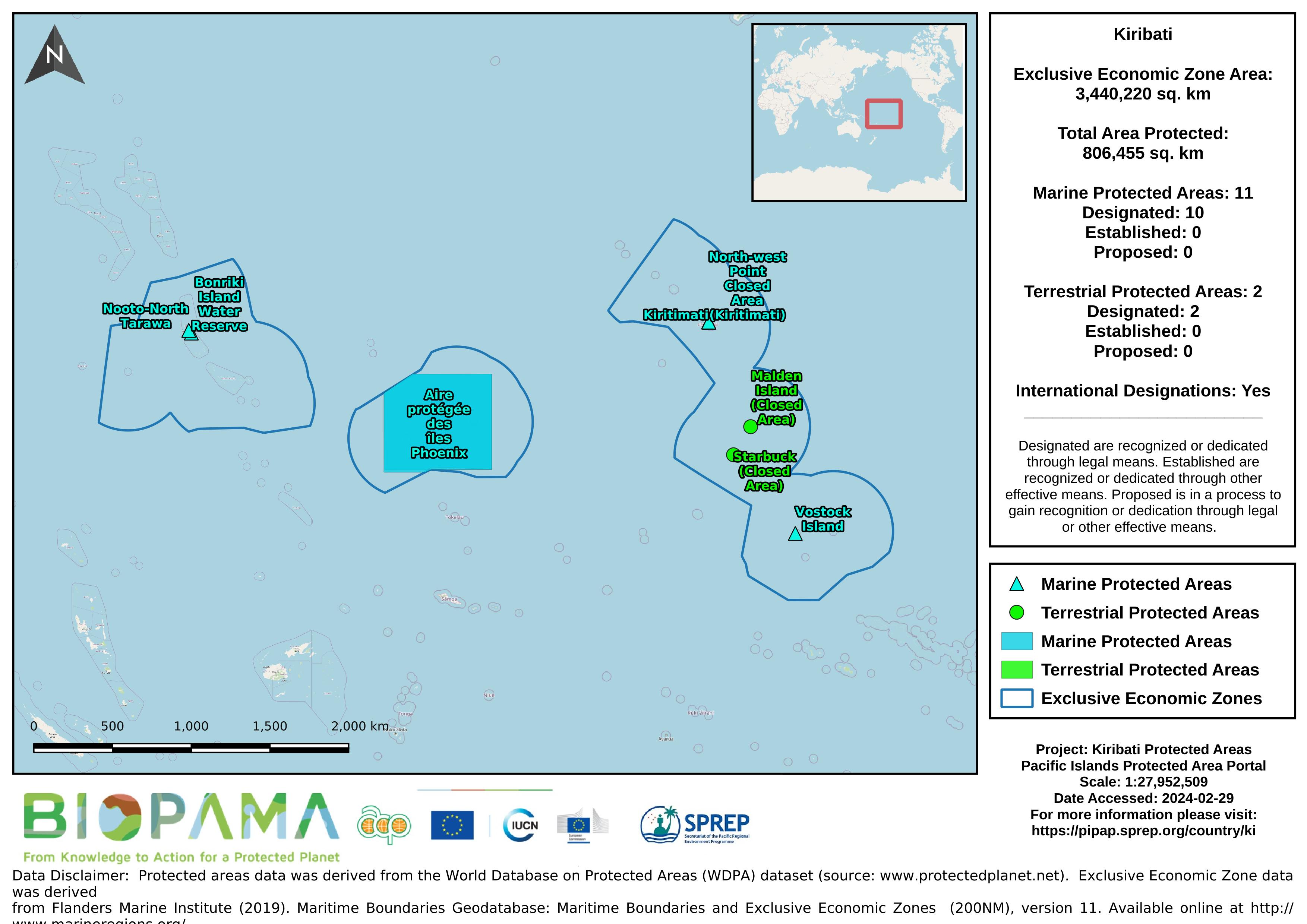
Map of the protected areas for Kiribati with country-level summary statistics on the amount of area under protection, count for each type of protected area (terrestrial or marine), and the count of their designation.
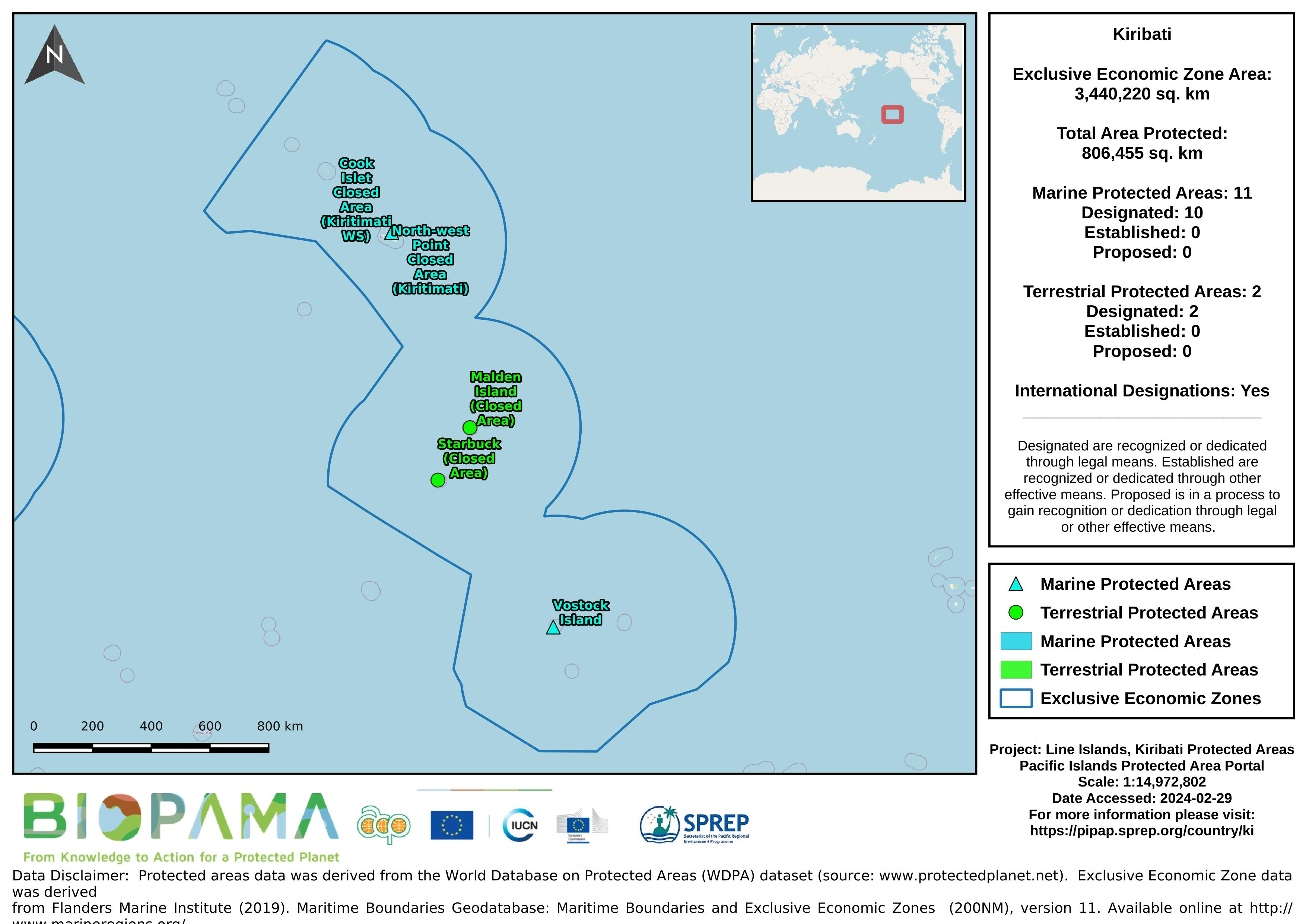
Map of the protected areas for the Line Islands, Kiribati with country-level summary statistics on the amount of area under protection, count for each type of protected area (terrestrial or marine), and the count of their designation.
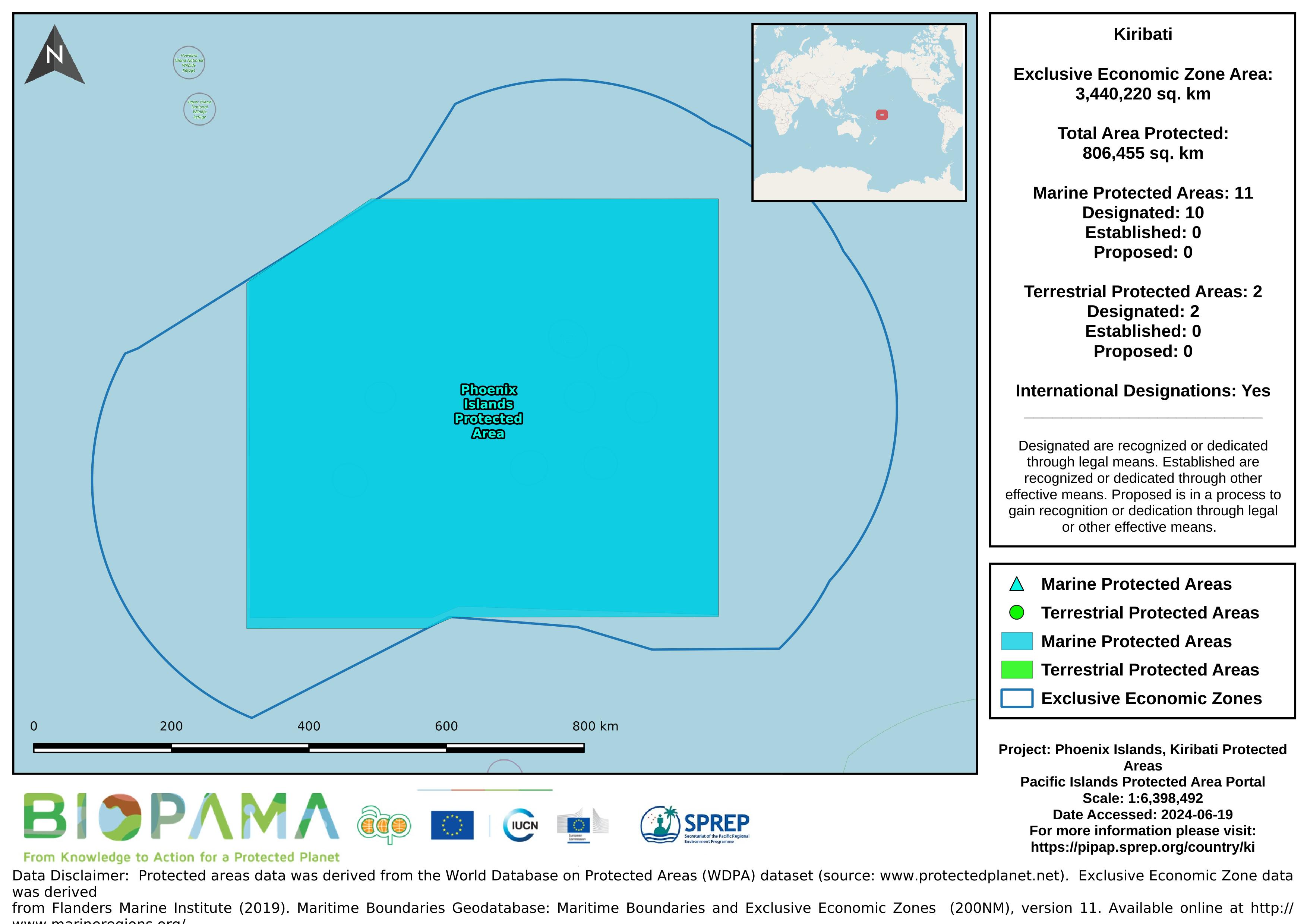
Map of the protected areas for the Phoenix Islands, Kiribati with country-level summary statistics on the amount of area under protection, count for each type of protected area (terrestrial or marine), and the count of their designation.
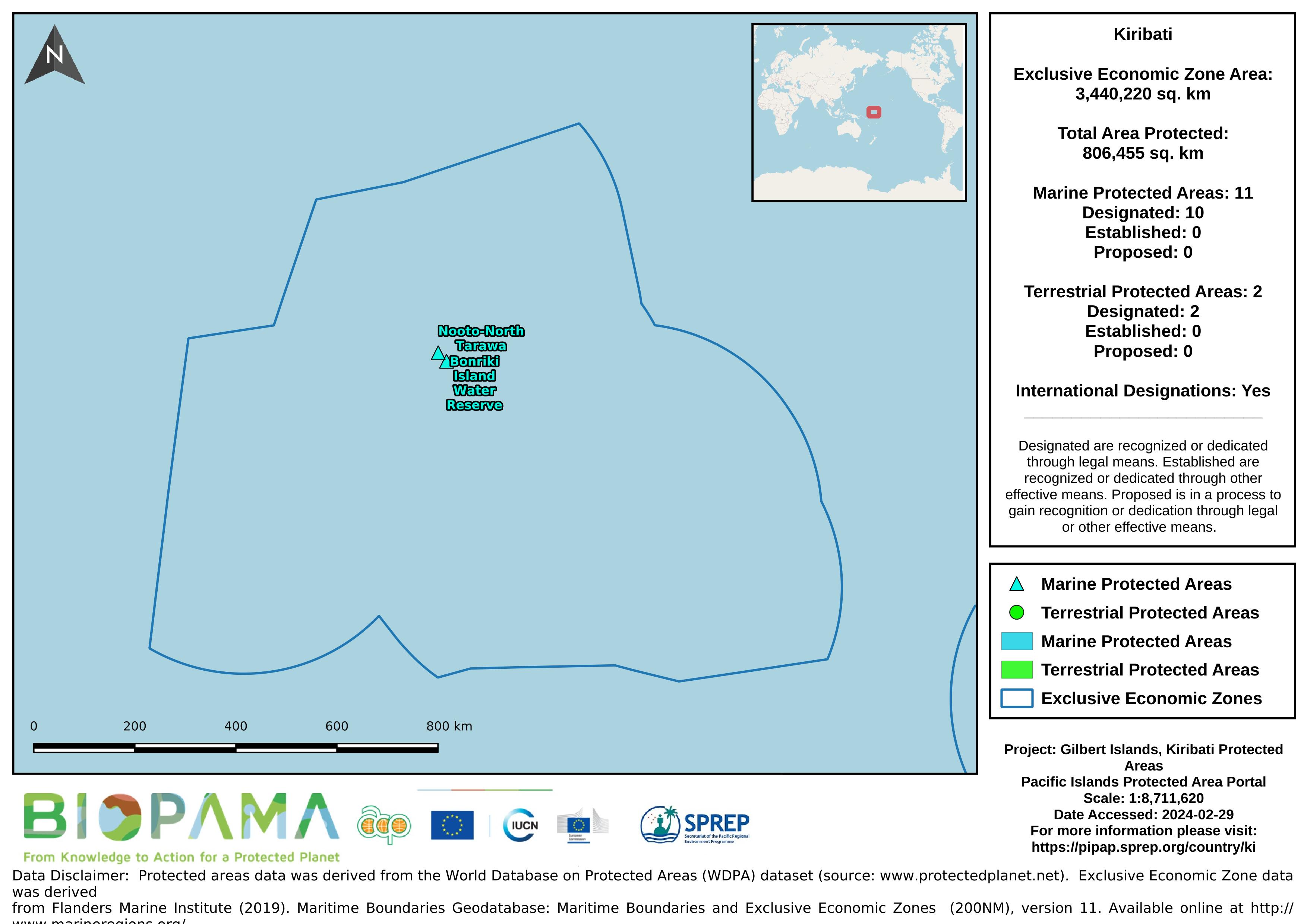
Map of the protected areas for the Gilbert Islands, Kiribati with country-level summary statistics on the amount of area under protection, count for each type of protected area (terrestrial or marine), and the count of their designation.
A .cvs format of the data in the excel sheet for easier and immediate reading and interpretation.
Each value represents the number of dumping events observed on fishing vessels during the period 2003-2015
a mapping representation of active and passive continental margins, oceanic plate boundaries and mid ocean spreading ridges
statistical records as of 2014 on the distribution of seamount. Accordingly, there are more seamounts in the Pacific Ocean than in the Atlantic, and their distribution can be described as comprising several elongate chains of seamounts superimposed on a more or less random background distribution (Craig and Sandwell)
Data submitted to the UN Ozone Secretariat highlighting the trend of ODS consumption (calculated as Production (if any) + imports - exports) in Kiribati. Ozone Depleting Substances calculated here are HCFCs and Methal Bromide.
AquaMaps are computer-generated predictions of natural occurrence of marine species, based on the environmental tolerance of a given species with respect to depth, salinity, temperature, primary productivity, and its association with sea ice or coastal areas. These 'environmental envelopes' are matched against an authority file which contains respective information for the Oceans of the World. Independent knowledge such as distribution by FAO areas or bounding boxes are used to avoid mapping species in areas that contain suitable habitat, but are not occupied by the species.
Dataset regarding 'Seamounts' - peaks that rise over 1,000 m above the seafloor. Seamount chains occur in all three major ocean basins, with the Pacific having the most number and most extensive seamount chains.
The dataset contains a range of different Pacific regional maps developed by the SPREP GIS team and is available for use by members and partners.
The data consists of protected area in Kiribati
The World Database on Protected Areas (WDPA) is the most comprehensive global database of marine and terrestrial protected areas, updated on a monthly basis, and is one of the key global biodiversity data sets being widely used by scientists, businesses, governments, International secretariats and others to inform planning, policy decisions and management. The WDPA is a joint project between UN Environment and the International Union for Conservation of Nature (IUCN).
A direct internet link to and resources pertaining the Blue Habitat website which has been established as a portal for information on the global distribution of marine ‘blue’ habitats. Knowledge on the distribution of blue habitats is an important input into ocean management, marine spatial planning and biodiversity conservation.
ICUN Redlist category for Kiribati
Maps and associated data from the Turtle Research and Monitoring Database System (TREDS). A summary of the database can be found below.
The Turtle Research and Monitoring Database System (TREDS) provides invaluable information for Pacific island countries and territories to manage their turtle resources. TREDS can be used to collate data from strandings, tagging, nesting, emergence and beach surveys as well as other biological data on turtles.
CVS version of the data in excel