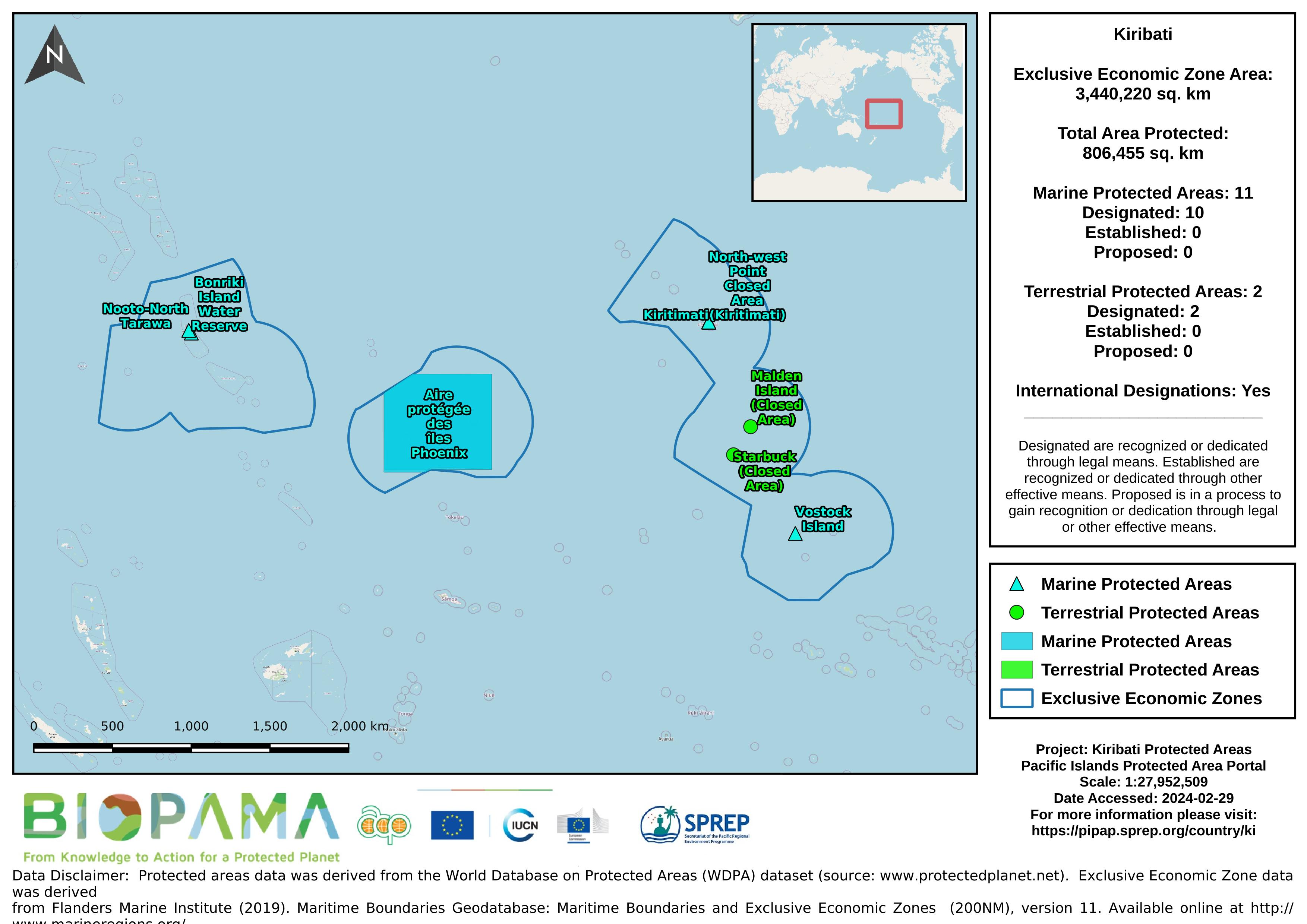
Map of the protected areas for Kiribati with country-level summary statistics on the amount of area under protection, count for each type of protected area (terrestrial or marine), and the count of their designation.
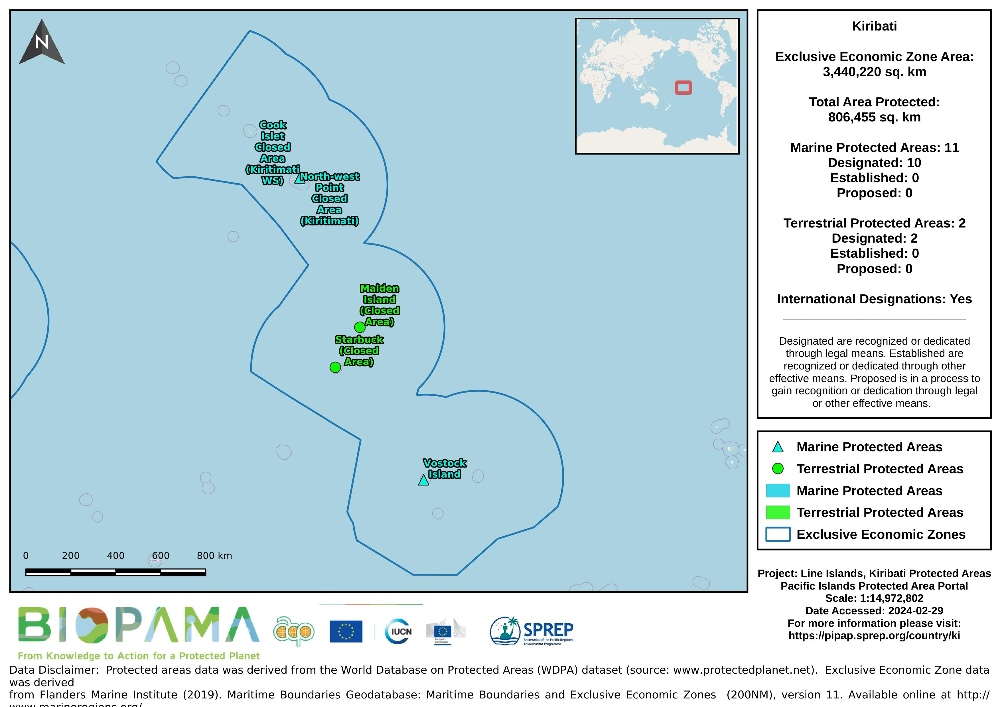
Map of the protected areas for the Line Islands, Kiribati with country-level summary statistics on the amount of area under protection, count for each type of protected area (terrestrial or marine), and the count of their designation.
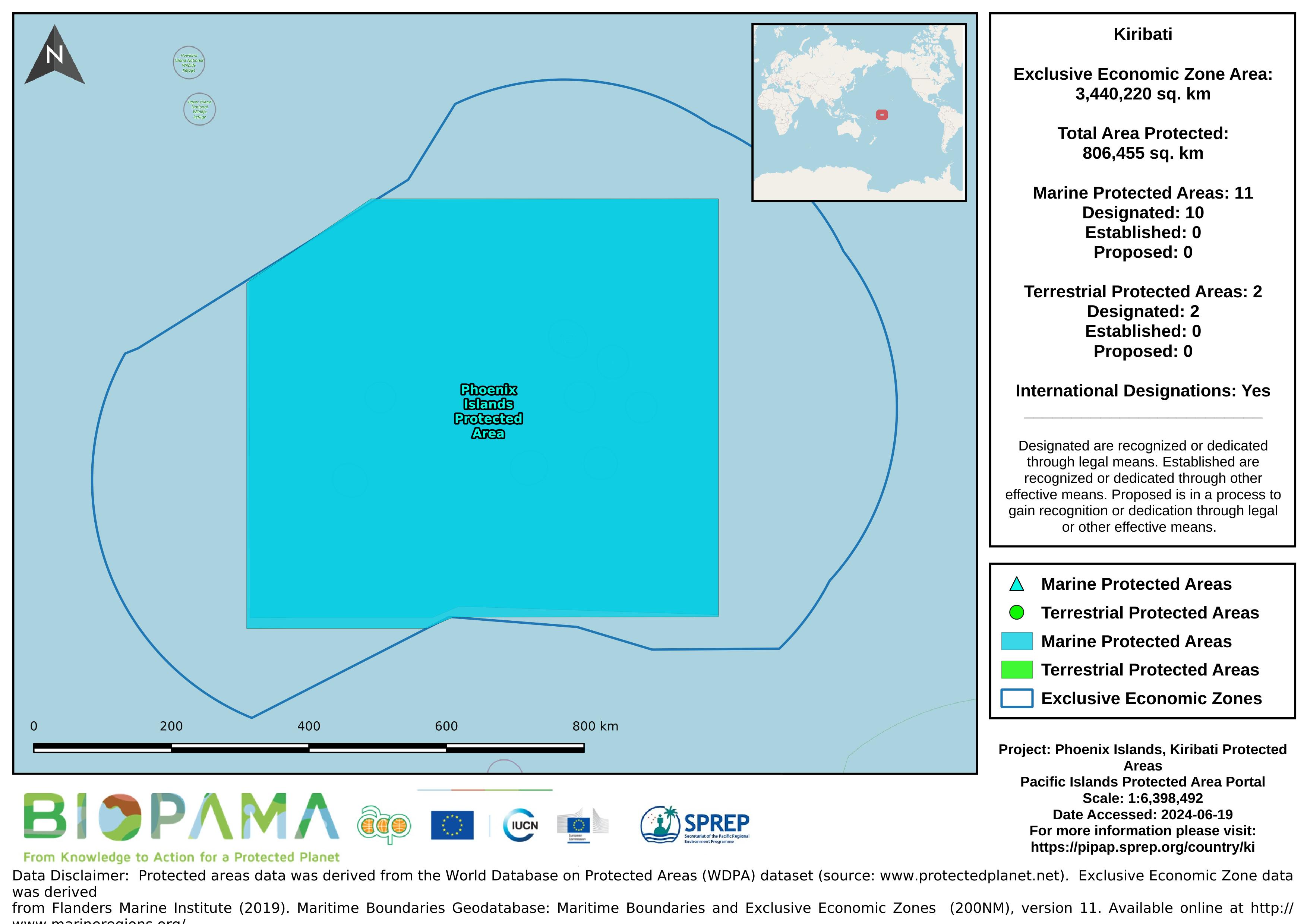
Map of the protected areas for the Phoenix Islands, Kiribati with country-level summary statistics on the amount of area under protection, count for each type of protected area (terrestrial or marine), and the count of their designation.
Time series data on the consumption of HCFCs and methal bromid in Kiribati submitted to Ozone Secretariat.
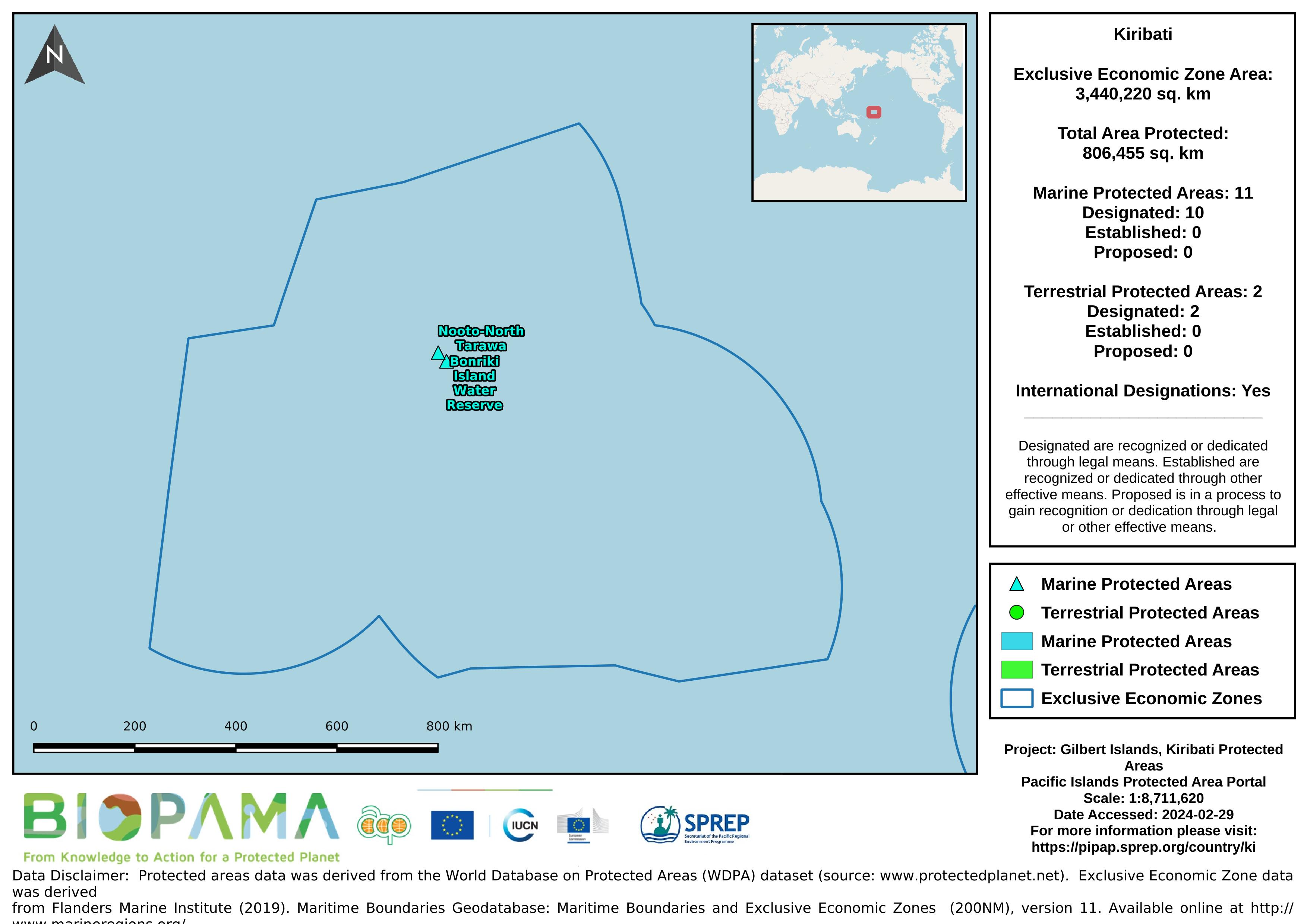
Map of the protected areas for the Gilbert Islands, Kiribati with country-level summary statistics on the amount of area under protection, count for each type of protected area (terrestrial or marine), and the count of their designation.
a mapping representation of active and passive continental margins, oceanic plate boundaries and mid ocean spreading ridges
statistical records as of 2014 on the distribution of seamount. Accordingly, there are more seamounts in the Pacific Ocean than in the Atlantic, and their distribution can be described as comprising several elongate chains of seamounts superimposed on a more or less random background distribution (Craig and Sandwell)
This is a template that can be used when creating a State of Environment report, and sections can be added or adapted to fit a country’s needs.
SPREPs recommended template for individual indicators in national SoE reports. The full SoE template will be updated in the coming months.
Data submitted to the UN Ozone Secretariat highlighting the trend of ODS consumption (calculated as Production (if any) + imports - exports) in Kiribati. Ozone Depleting Substances calculated here are HCFCs and Methal Bromide.
Reefs at Risk Revisited is a high-resolution update of the original global analysis, Reefs at Risk: A Map-Based Indicator of Threats to the World’s Coral Reefs. Reefs at Risk Revisited uses a global map of coral reefs at 500-m resolution, which is 64 times more detailed than the 4-km resolution map used in the 1998 analysis, and benefits from improvements in many global data sets used to evaluate threats to reefs (most threat data are at 1 km resolution, which is 16 times more detailed than those used in the 1998 analysis).
This dataset contains templates of policies and MoU's on data sharing.
You can download the Word-templates and adapt the documents to your national context.
A collection of Inform project training materials. You are free to download and use any of the training resources below. The PowerPoint presentations contain a complete set of slides, so please feel free to copy, delete or change slides, to fit the purpose of your country training.
Dataset regarding 'Seamounts' - peaks that rise over 1,000 m above the seafloor. Seamount chains occur in all three major ocean basins, with the Pacific having the most number and most extensive seamount chains.
The dataset contains a range of different Pacific regional maps developed by the SPREP GIS team and is available for use by members and partners.
The World Database on Protected Areas (WDPA) is the most comprehensive global database of marine and terrestrial protected areas, updated on a monthly basis, and is one of the key global biodiversity data sets being widely used by scientists, businesses, governments, International secretariats and others to inform planning, policy decisions and management. The WDPA is a joint project between UN Environment and the International Union for Conservation of Nature (IUCN).
A direct internet link to and resources pertaining the Blue Habitat website which has been established as a portal for information on the global distribution of marine ‘blue’ habitats. Knowledge on the distribution of blue habitats is an important input into ocean management, marine spatial planning and biodiversity conservation.
Forest area for pacific island countries