Map of the protected areas for Kiribati with country-level summary statistics on the amount of area under protection, count for each type of protected area (terrestrial or marine), and the count of their designation.
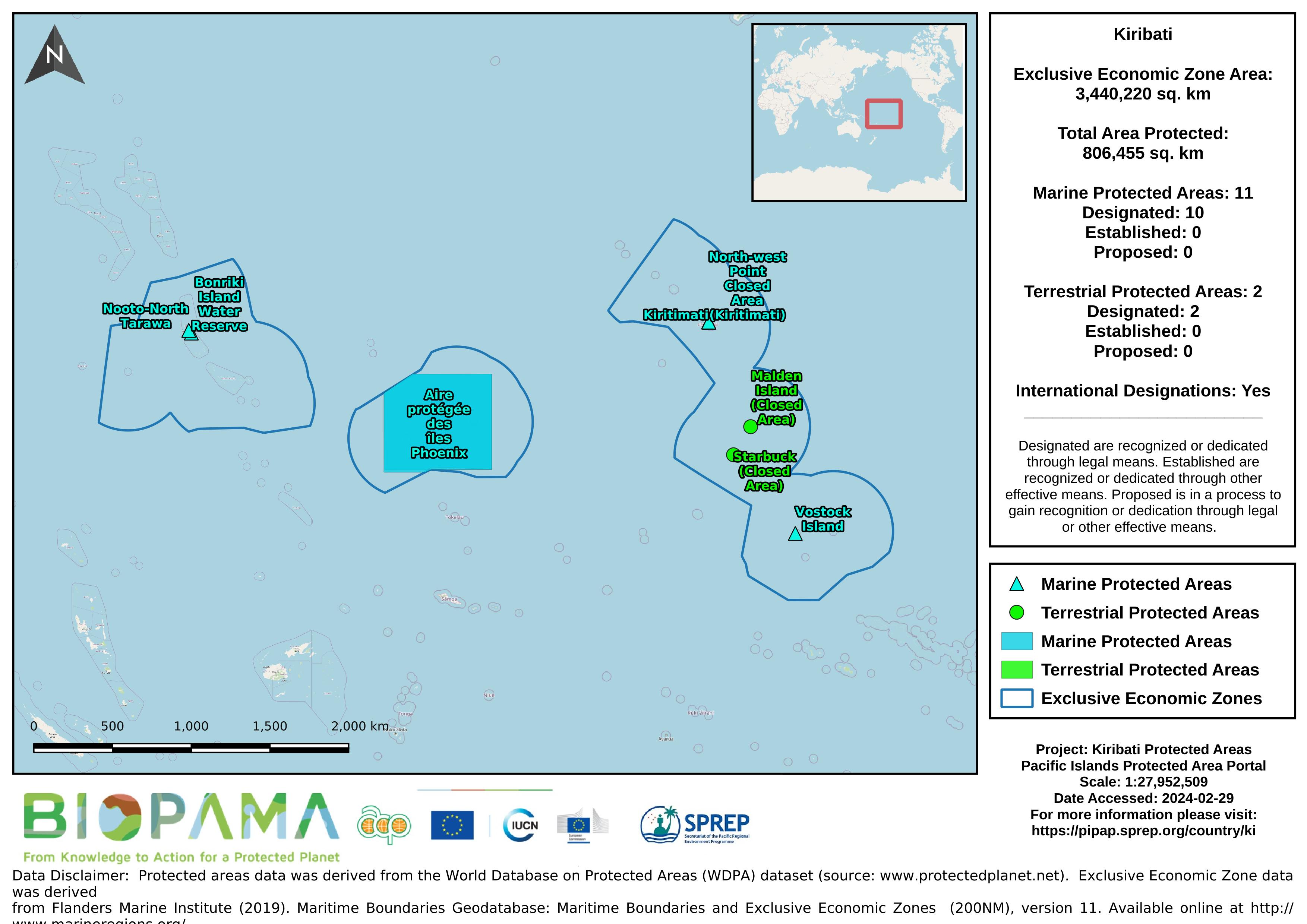
Map of the protected areas for the Line Islands, Kiribati with country-level summary statistics on the amount of area under protection, count for each type of protected area (terrestrial or marine), and the count of their designation.
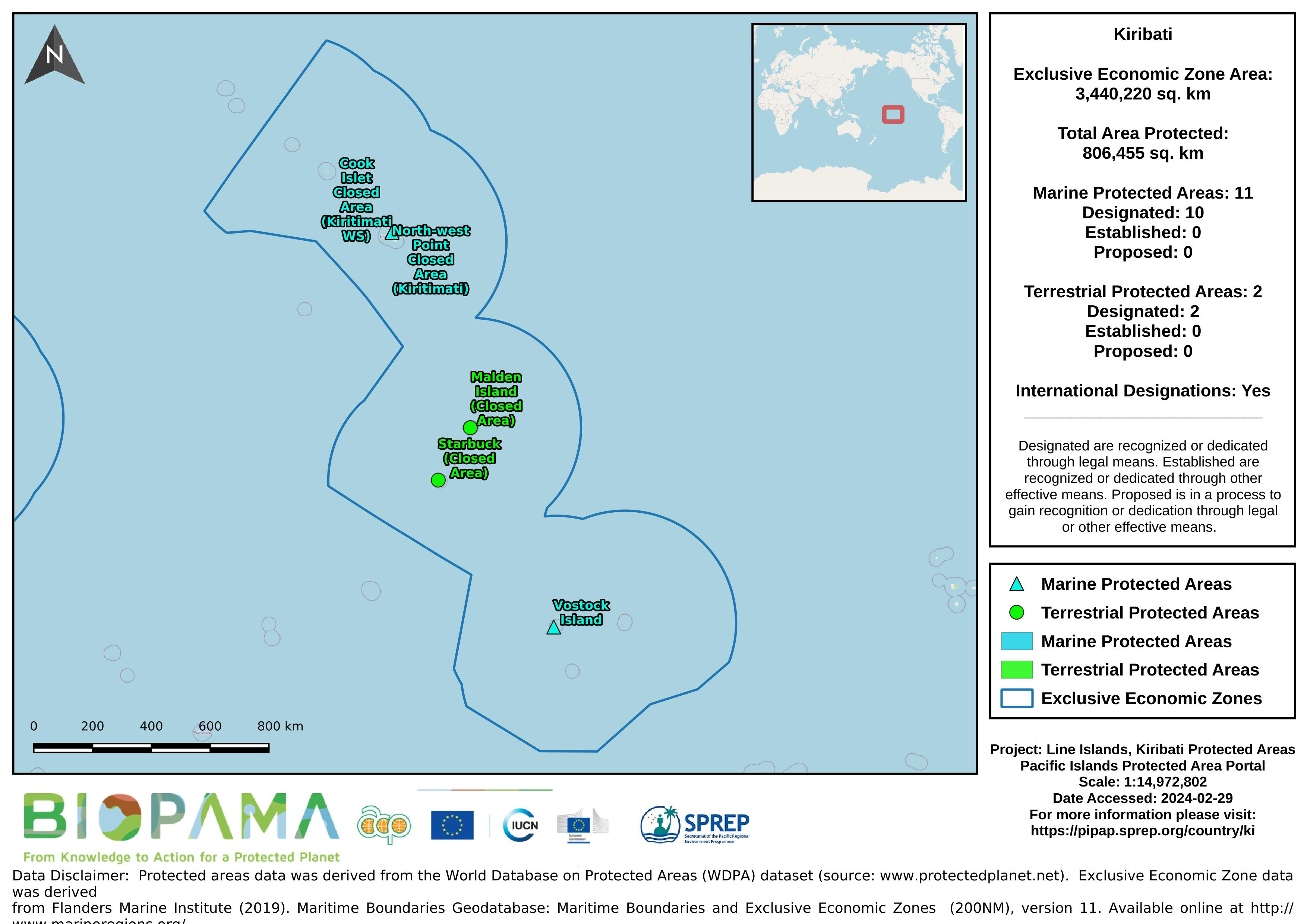
Map of the protected areas for the Phoenix Islands, Kiribati with country-level summary statistics on the amount of area under protection, count for each type of protected area (terrestrial or marine), and the count of their designation.
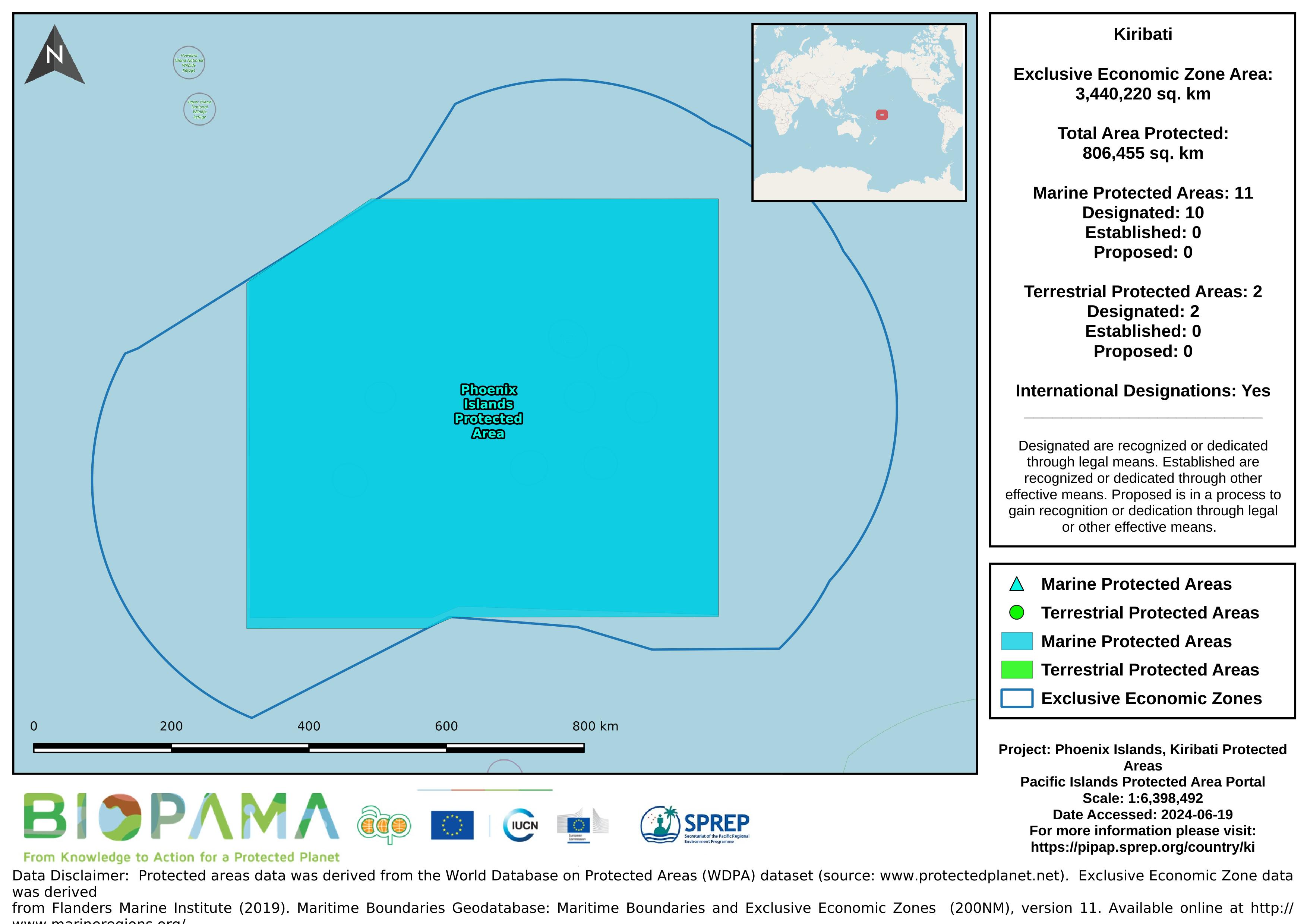
Map of the protected areas for the Gilbert Islands, Kiribati with country-level summary statistics on the amount of area under protection, count for each type of protected area (terrestrial or marine), and the count of their designation.
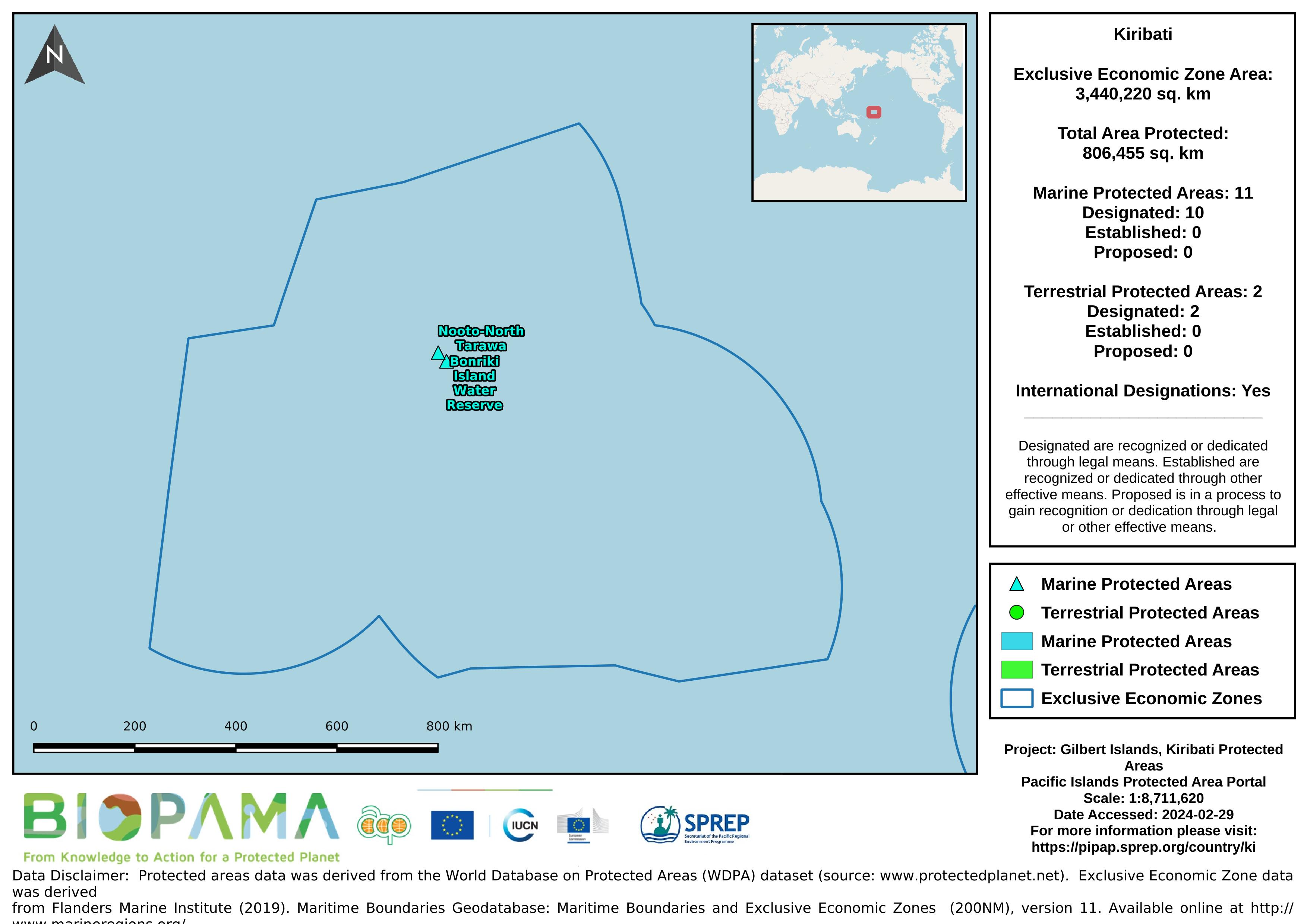
A .cvs format of the data in the excel sheet for easier and immediate reading and interpretation.
Each value represents the number of dumping events observed on fishing vessels during the period 2003-2015
a mapping representation of active and passive continental margins, oceanic plate boundaries and mid ocean spreading ridges
statistical records as of 2014 on the distribution of seamount. Accordingly, there are more seamounts in the Pacific Ocean than in the Atlantic, and their distribution can be described as comprising several elongate chains of seamounts superimposed on a more or less random background distribution (Craig and Sandwell)
CVS version of the data in excel
CSV file containing the global distribution of hydrothermal vent fields in WGS84 coordinate system.
CSV file containing species richness values and mapping parameters for marine species (with a probability of occurrence > 0.5) derived from AquaMaps. A total of 33,512 species were used in the generation of this file.
Coordinate system is WGS84 (ESPG 4326) with coordinates expressed in longitude and latitude.
Fields in this file are:
C-Square Code: unique identifier for grid
Longitude: longitude in decimal degrees
Latitude: latitude in decimal degrees
Species Count: number of species modeled at given point
The Open Database License (ODbL) is a license agreement intended to
allow users to freely share, modify, and use this Database while
maintaining this same freedom for others. Many databases are covered by
copyright, and therefore this document licenses these rights. Some
jurisdictions, mainly in the European Union, have specific rights that
cover databases, and so the ODbL addresses these rights, too. Finally,
the ODbL is also an agreement in contract for users of this Database to
act in certain ways in return for accessing this Database.
From the Turtle Research and Monitoring Database System (TREDS)
From the Turtle Research and Monitoring Database System (TREDS)
From the Turtle Research and Monitoring Database System (TREDS)
From the Turtle Research and Monitoring Database System (TREDS)
From the Turtle Research and Monitoring Database System (TREDS)
From the Turtle Research and Monitoring Database System (TREDS)