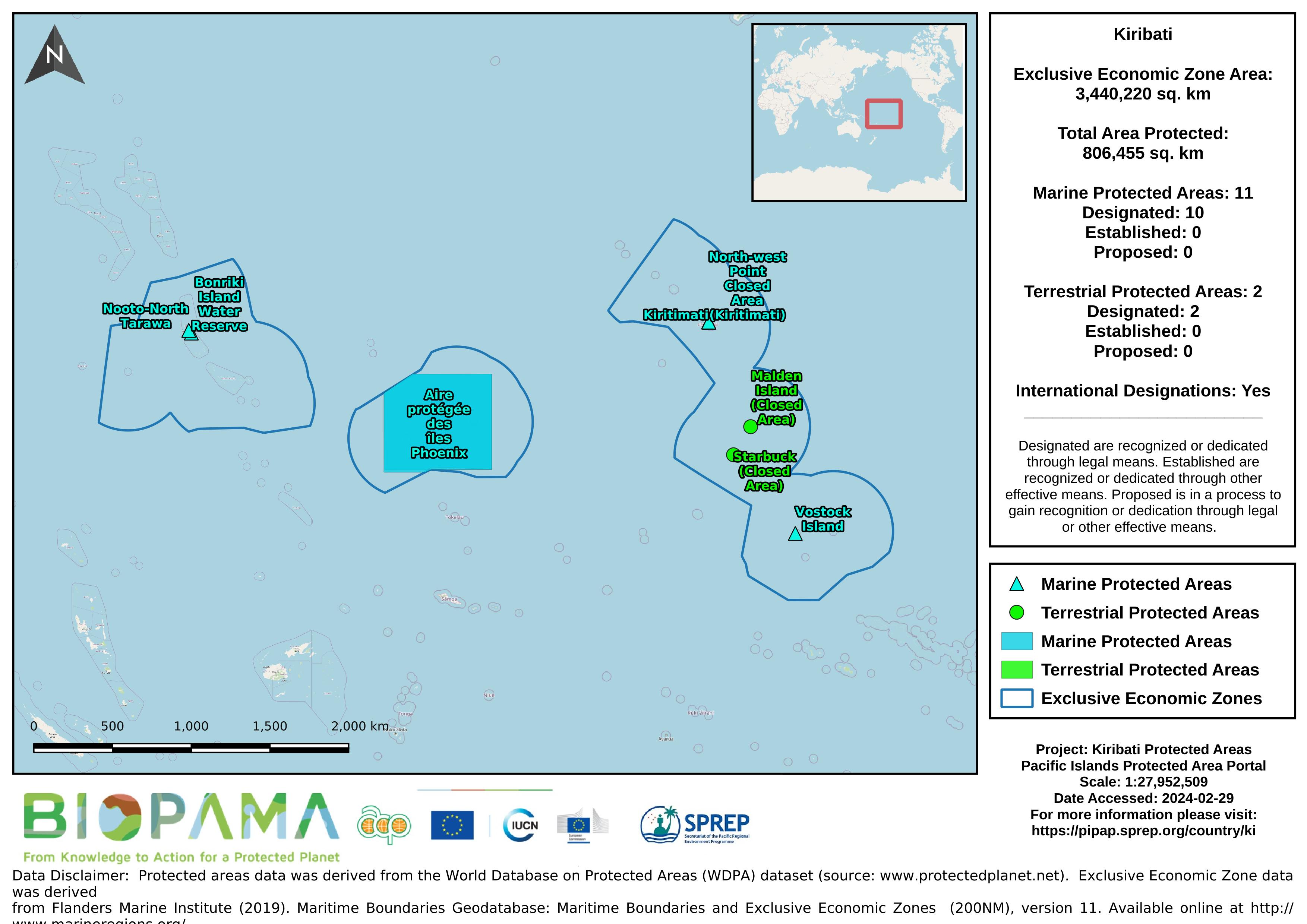
Map of the protected areas for Kiribati with country-level summary statistics on the amount of area under protection, count for each type of protected area (terrestrial or marine), and the count of their designation.
Map of the protected areas for Kiribati with country-level summary statistics on the amount of area under protection, count for each type of protected area (terrestrial or marine), and the count of their designation.
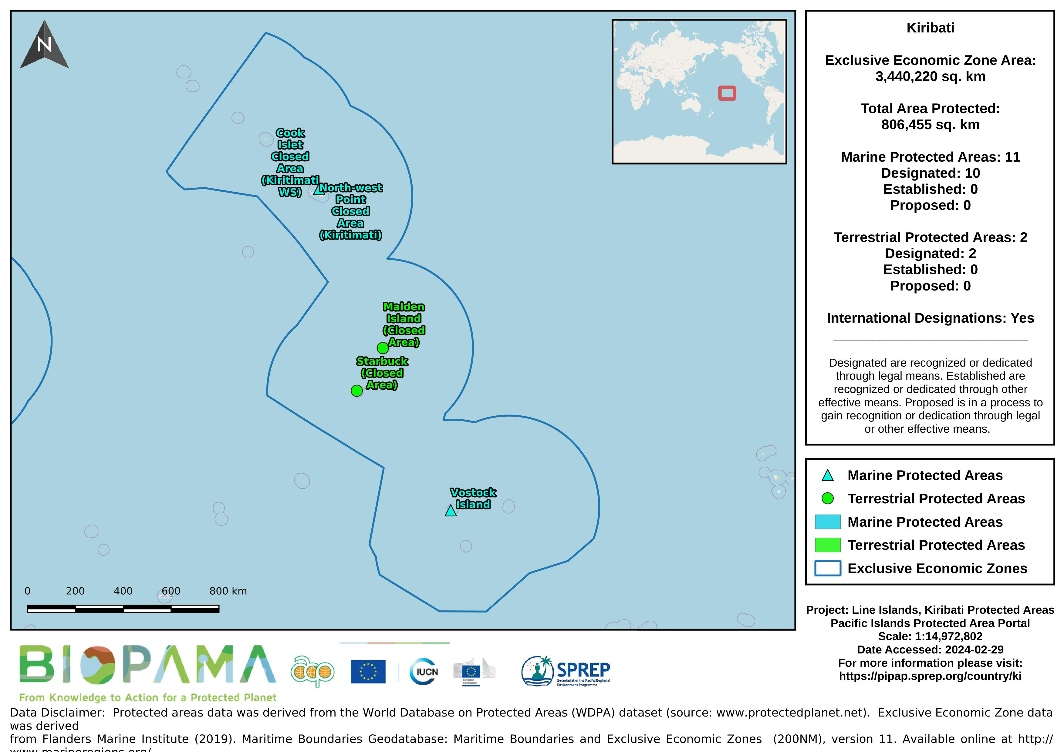
Map of the protected areas for the Line Islands, Kiribati with country-level summary statistics on the amount of area under protection, count for each type of protected area (terrestrial or marine), and the count of their designation.
Map of the protected areas for the Line Islands, Kiribati with country-level summary statistics on the amount of area under protection, count for each type of protected area (terrestrial or marine), and the count of their designation.
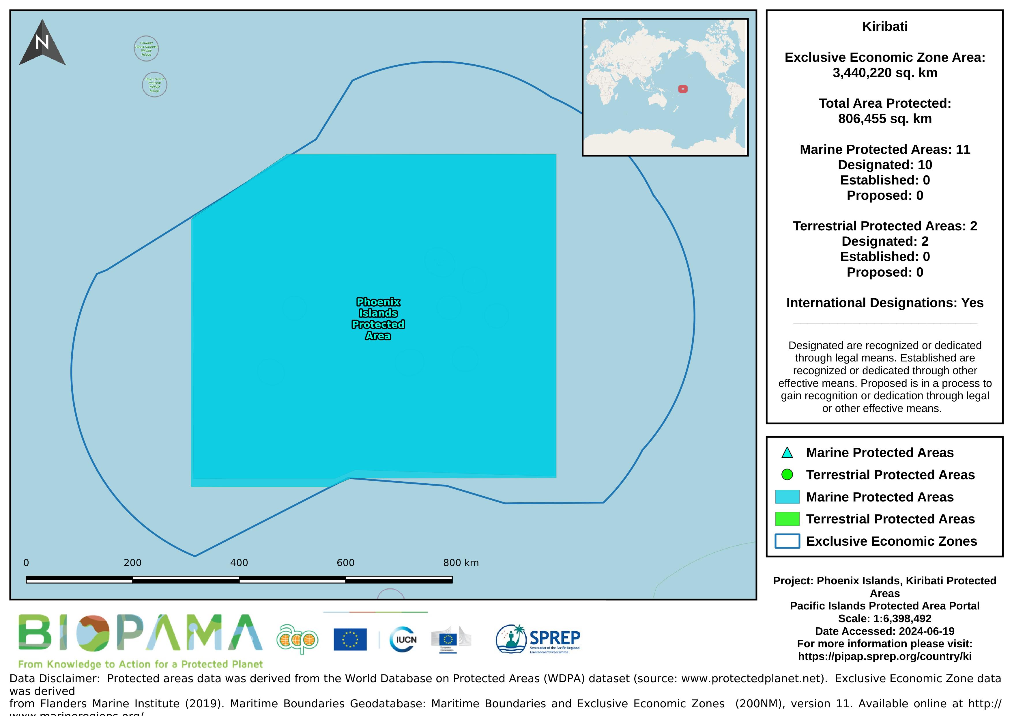
Map of the protected areas for the Phoenix Islands, Kiribati with country-level summary statistics on the amount of area under protection, count for each type of protected area (terrestrial or marine), and the count of their designation.
Map of the protected areas for the Phoenix Islands, Kiribati with country-level summary statistics on the amount of area under protection, count for each type of protected area (terrestrial or marine), and the count of their designation.
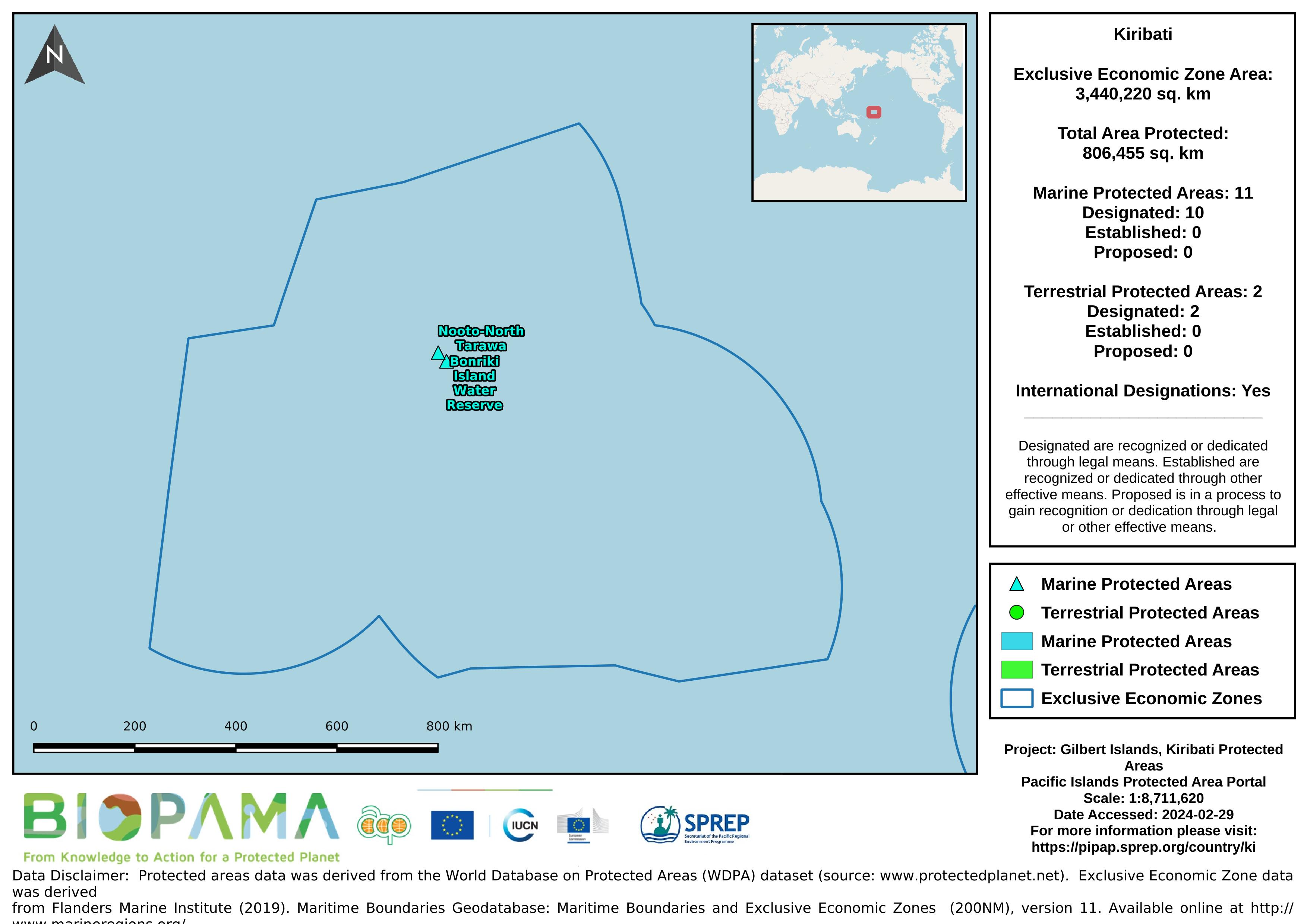
Map of the protected areas for the Gilbert Islands, Kiribati with country-level summary statistics on the amount of area under protection, count for each type of protected area (terrestrial or marine), and the count of their designation.
Map of the protected areas for the Gilbert Islands, Kiribati with country-level summary statistics on the amount of area under protection, count for each type of protected area (terrestrial or marine), and the count of their designation.
A .cvs format of the data in the excel sheet for easier and immediate reading and interpretation.
The increased demand for high quality products in export markets, coupled with Pacific Island Countries (PICs) national desire to protect the environment, biodiversity and family farming structures, lead to assume that organic agriculture could offer good prospects for PICs development. Besides market opportunities, organic agriculture could increase PICs food self-reliance and thus, contribute to reducing the alarming trend of dependency on food imports, as well as improving nutrition.
Each value represents the number of dumping events observed on fishing vessels during the period 2003-2015
This is a template that can be used when creating a State of Environment report, and sections can be added or adapted to fit a country’s needs.
SPREPs recommended template for individual indicators in national SoE reports. The full SoE template will be updated in the coming months.
CVS version of the data in excel
At the end of a training, you can ask participants to fill in this Action Plan. The goal is to link learning to performance.
This policy applies requests for data held by a Ministry. The purpose of this policy is to:
• encourage the free exchange of data within a Ministry, with other government agencies within the country and with the public, as appropriate
• ensure that sensitive information (including commercially sensitive data) held by the Ministry is not compromised.
Memorandum of Understanding between two parties, for the exchange of data, related information and other services.
Memorandum of Understanding between SPREP and a Country, to facilitate the access to, and security of, all data entered into the national database.