This dataset contains mapped point locations for protected areas within Kiribati. This dataset should be viewed in combination with the World Database on Protected Areas polygon locations to get a comprehensive view of all protected areas within Kiribati.
This dataset contains mapped polygon locations for protected areas within Kiribati. This dataset should be viewed in combination with the World Database on Protected Areas point locations to get a comprehensive view of all protected areas within Kiribati.
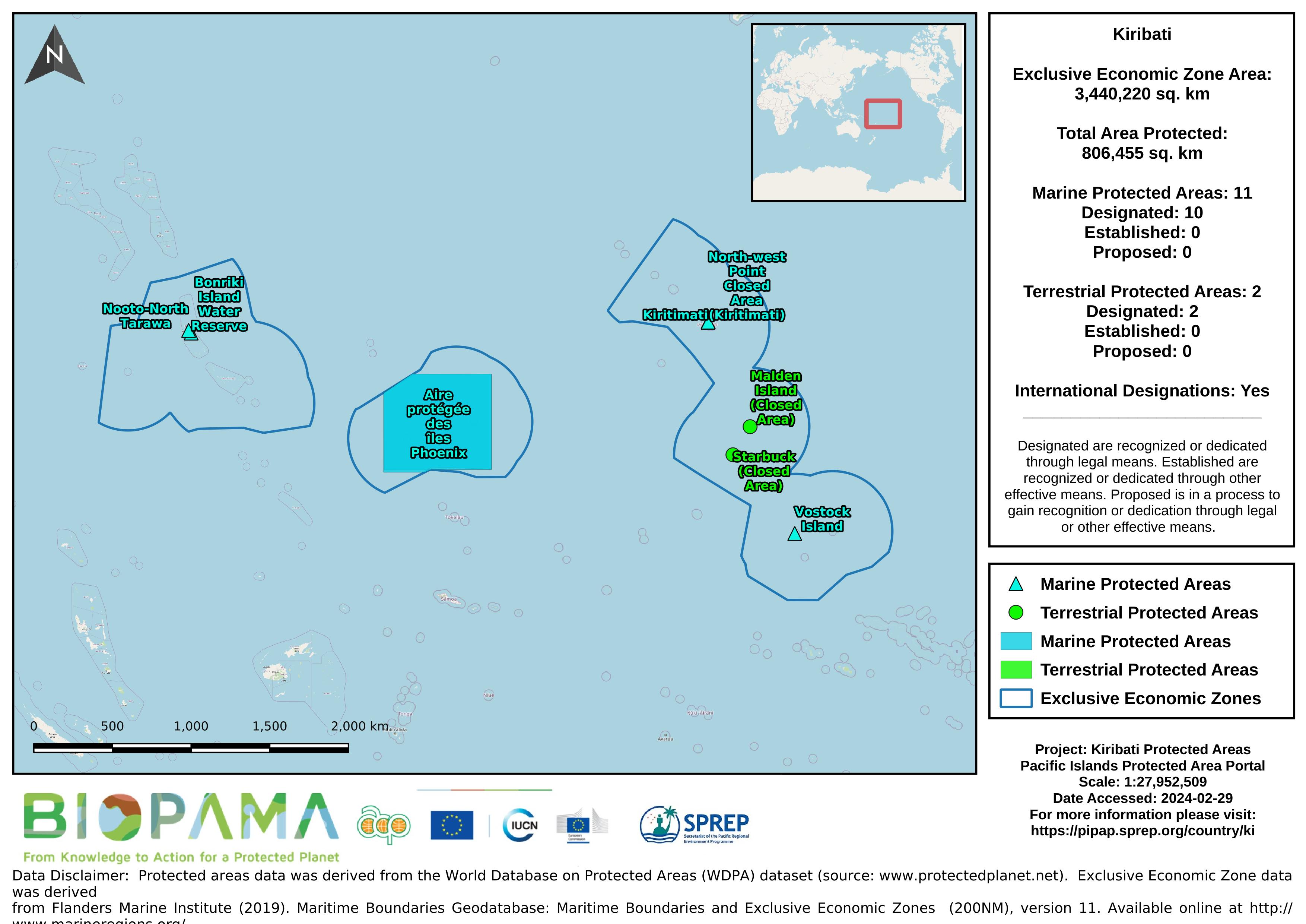
Map of the protected areas for Kiribati with country-level summary statistics on the amount of area under protection, count for each type of protected area (terrestrial or marine), and the count of their designation.
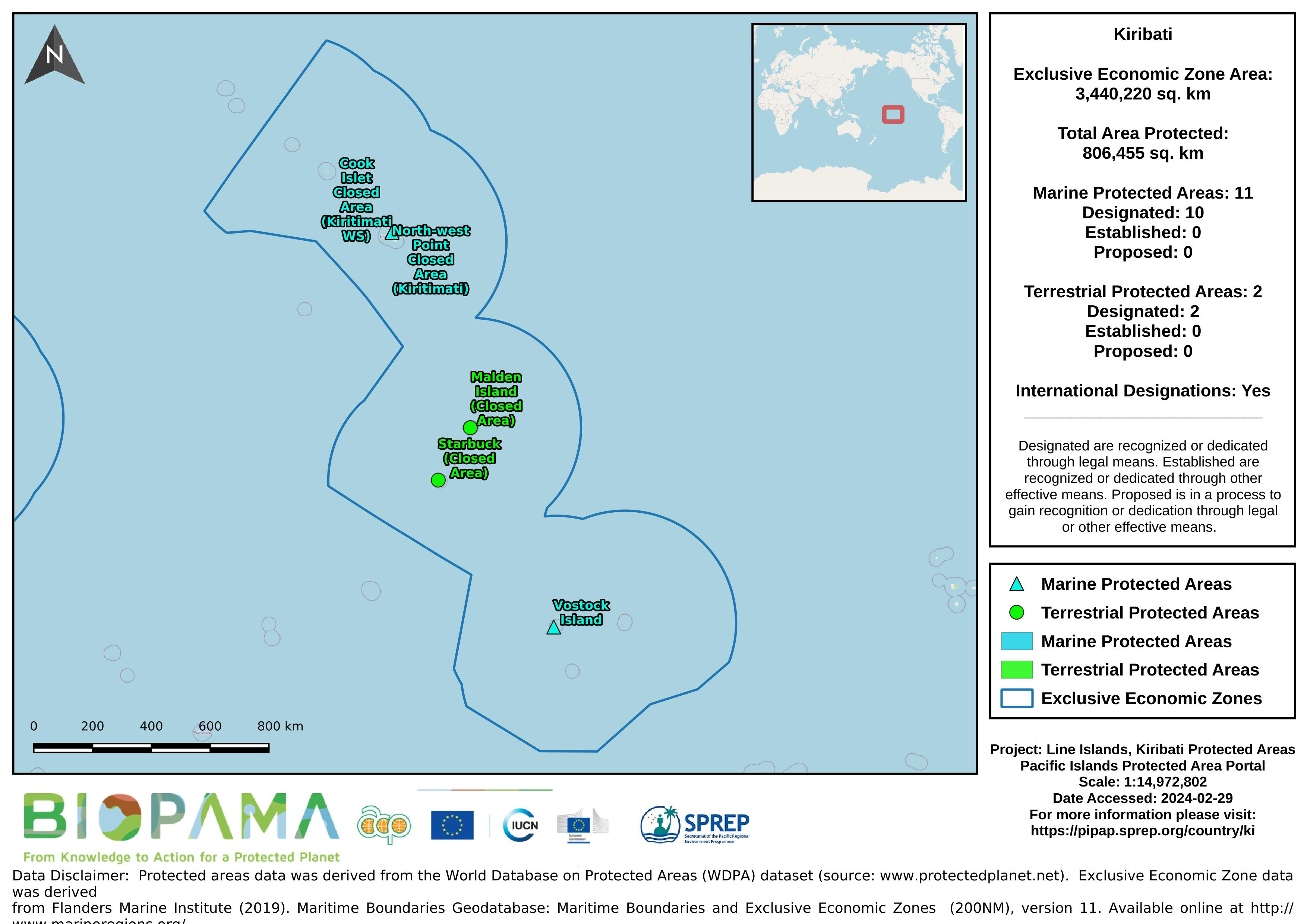
Map of the protected areas for the Line Islands, Kiribati with country-level summary statistics on the amount of area under protection, count for each type of protected area (terrestrial or marine), and the count of their designation.
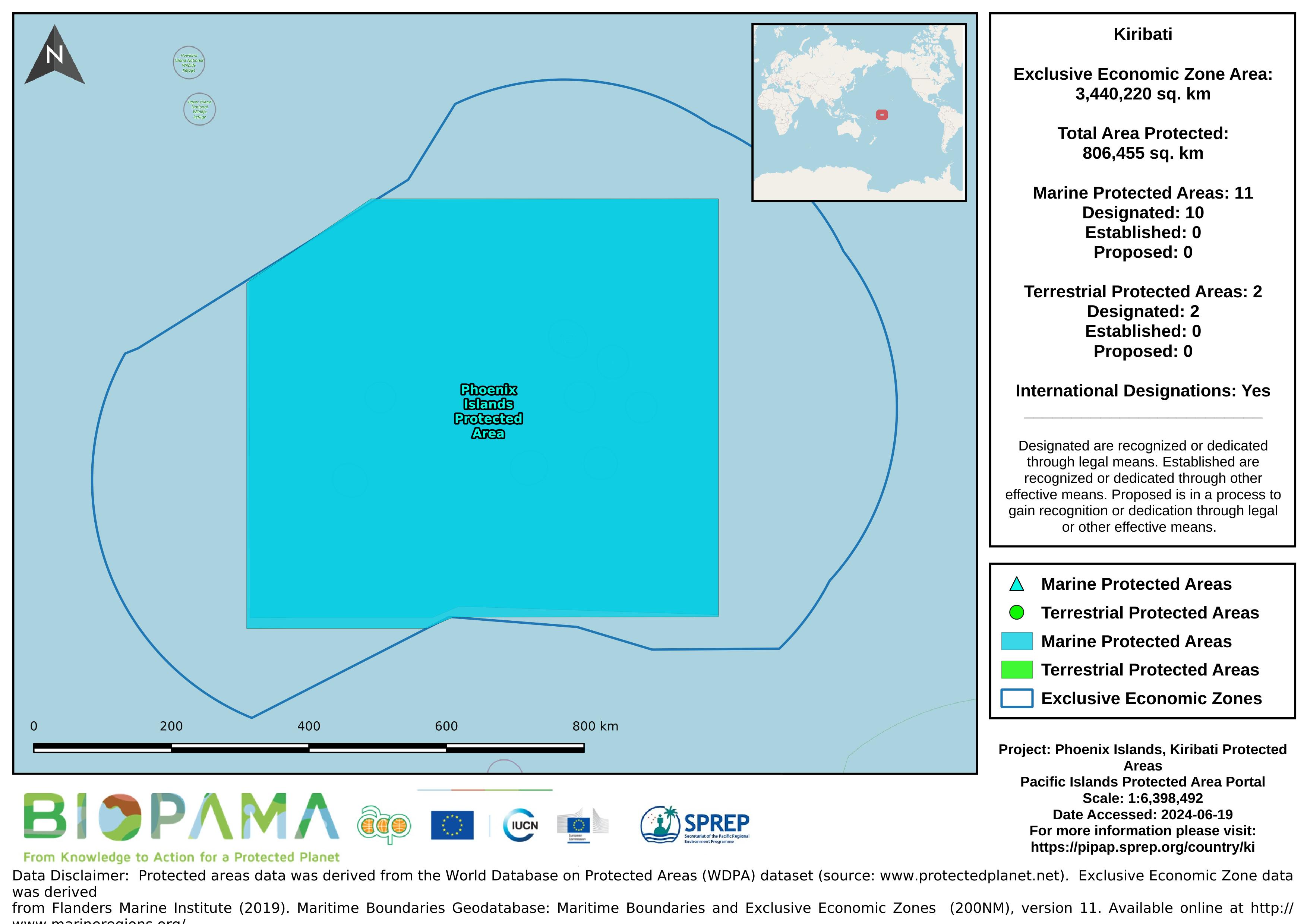
Map of the protected areas for the Phoenix Islands, Kiribati with country-level summary statistics on the amount of area under protection, count for each type of protected area (terrestrial or marine), and the count of their designation.
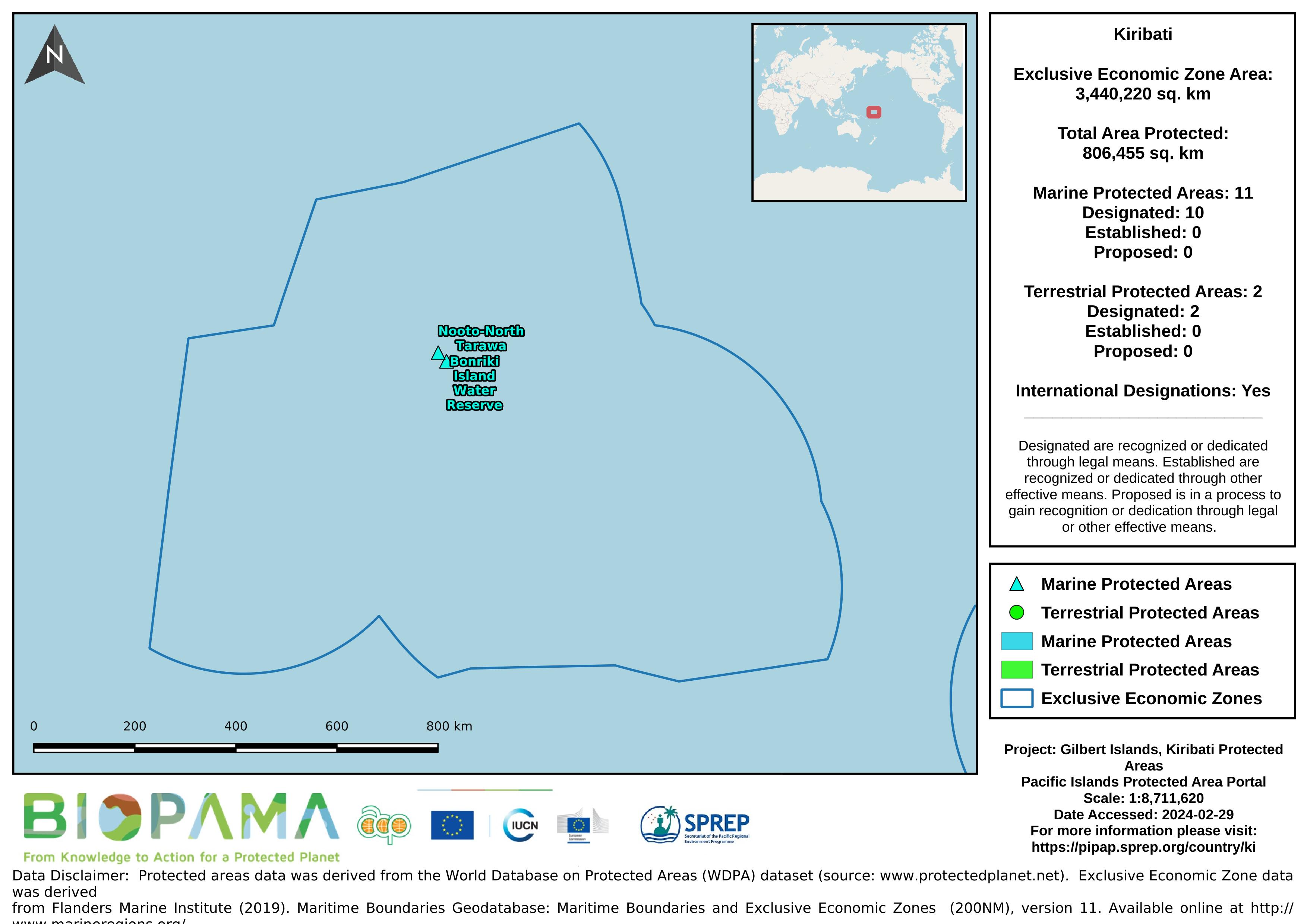
Map of the protected areas for the Gilbert Islands, Kiribati with country-level summary statistics on the amount of area under protection, count for each type of protected area (terrestrial or marine), and the count of their designation.
Pacific islands region exclusive economic zones (EEZs)
Pacific islands region land area
gis file with points on pollution incidents in the Solomon Islands
a mapping representation of active and passive continental margins, oceanic plate boundaries and mid ocean spreading ridges
statistical records as of 2014 on the distribution of seamount. Accordingly, there are more seamounts in the Pacific Ocean than in the Atlantic, and their distribution can be described as comprising several elongate chains of seamounts superimposed on a more or less random background distribution (Craig and Sandwell)
GeoJSON file for earthquake centers over a magnitude of 4.5 for the Pacific Islands Region for years 2000-2004. Data are derived from the ANSS Comprehensive Earthquake Catalog (ComCat). ComCat contains earthquake source parameters (e.g. hypocenters, magnitudes, phase picks and amplitudes) and other products (e.g. moment tensor solutions, macroseismic information, tectonic summaries, maps) produced by contributing seismic networks.
GeoJSON file for earthquake centers over a magnitude of 4.5 for the Pacific Islands Region for years 2005-2009. Data are derived from the ANSS Comprehensive Earthquake Catalog (ComCat). ComCat contains earthquake source parameters (e.g. hypocenters, magnitudes, phase picks and amplitudes) and other products (e.g. moment tensor solutions, macroseismic information, tectonic summaries, maps) produced by contributing seismic networks.
GeoJSON file for earthquake centers over a magnitude of 4.5 for the Pacific Islands Region for years 2010-2014. Data are derived from the ANSS Comprehensive Earthquake Catalog (ComCat). ComCat contains earthquake source parameters (e.g. hypocenters, magnitudes, phase picks and amplitudes) and other products (e.g. moment tensor solutions, macroseismic information, tectonic summaries, maps) produced by contributing seismic networks.
GeoJSON file for earthquake centers over a magnitude of 4.5 for the Pacific Islands Region for years 2015-2019. Data are derived from the ANSS Comprehensive Earthquake Catalog (ComCat). ComCat contains earthquake source parameters (e.g. hypocenters, magnitudes, phase picks and amplitudes) and other products (e.g. moment tensor solutions, macroseismic information, tectonic summaries, maps) produced by contributing seismic networks.
From the Turtle Research and Monitoring Database System (TREDS)
From the Turtle Research and Monitoring Database System (TREDS)
From the Turtle Research and Monitoring Database System (TREDS)
From the Turtle Research and Monitoring Database System (TREDS)
From the Turtle Research and Monitoring Database System (TREDS)