This dataset contains mapped point locations for protected areas within Kiribati. This dataset should be viewed in combination with the World Database on Protected Areas polygon locations to get a comprehensive view of all protected areas within Kiribati.
This dataset contains mapped polygon locations for protected areas within Kiribati. This dataset should be viewed in combination with the World Database on Protected Areas point locations to get a comprehensive view of all protected areas within Kiribati.
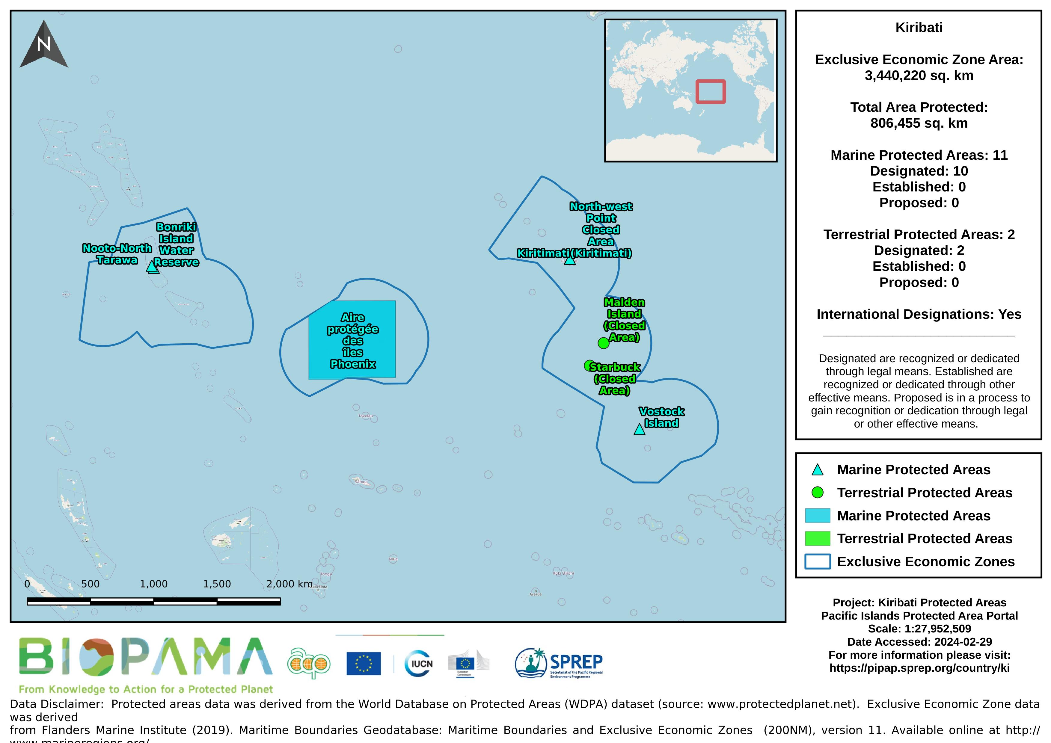
Map of the protected areas for Kiribati with country-level summary statistics on the amount of area under protection, count for each type of protected area (terrestrial or marine), and the count of their designation.
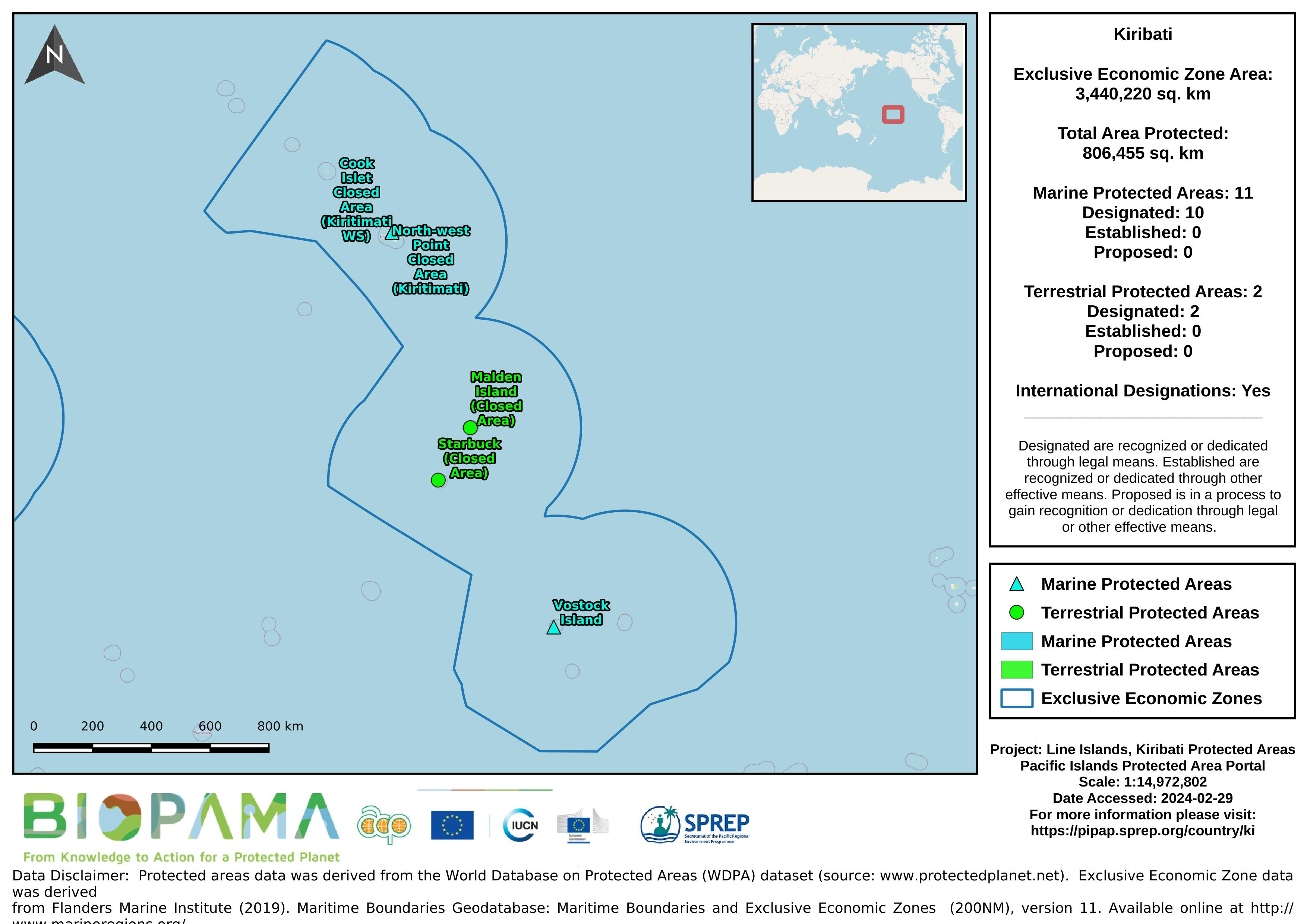
Map of the protected areas for the Line Islands, Kiribati with country-level summary statistics on the amount of area under protection, count for each type of protected area (terrestrial or marine), and the count of their designation.
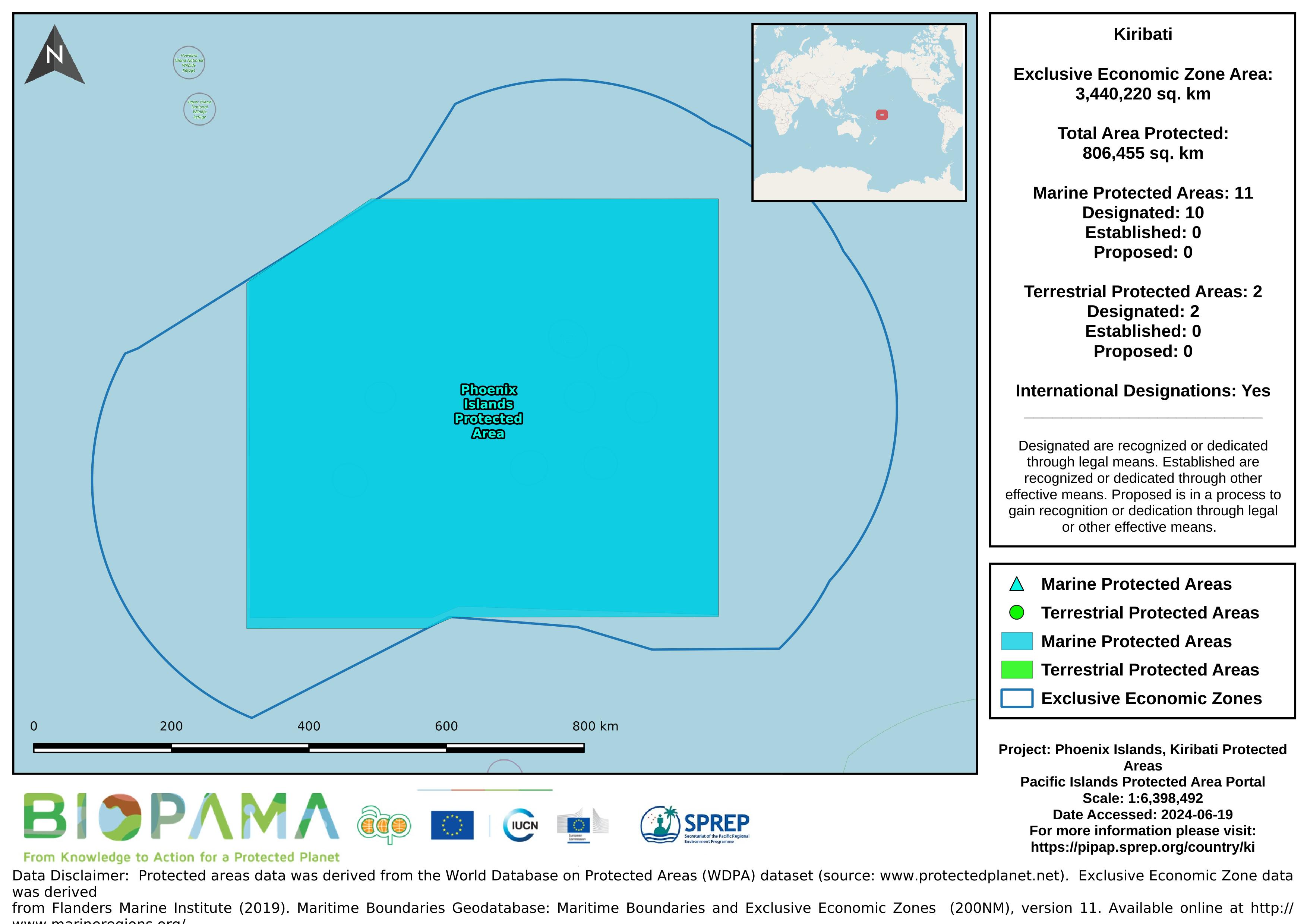
Map of the protected areas for the Phoenix Islands, Kiribati with country-level summary statistics on the amount of area under protection, count for each type of protected area (terrestrial or marine), and the count of their designation.
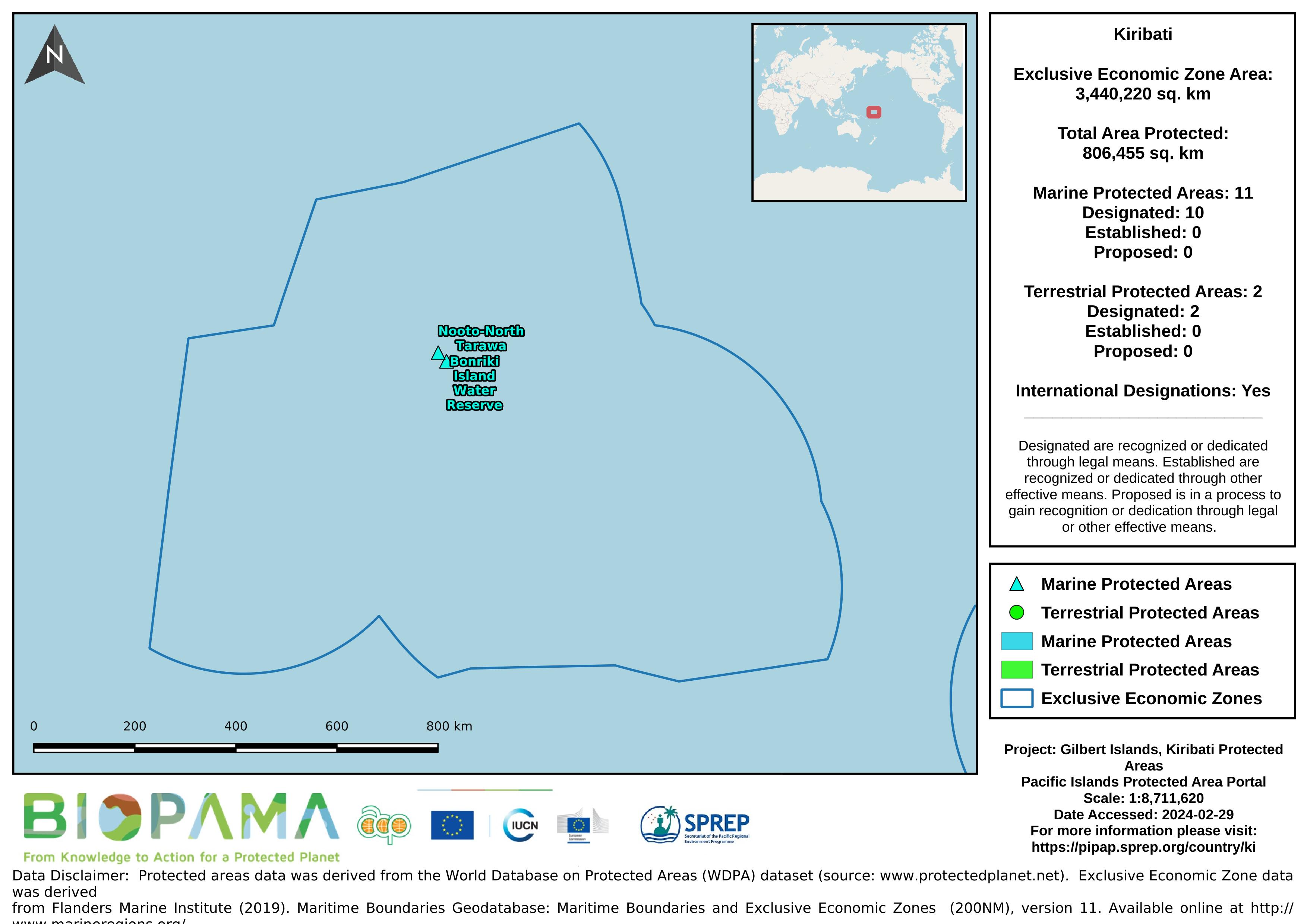
Map of the protected areas for the Gilbert Islands, Kiribati with country-level summary statistics on the amount of area under protection, count for each type of protected area (terrestrial or marine), and the count of their designation.
A direct internet link to access statistics and related info submitted to the UNEP Ozone Secretariat
A direct internet link to access statistics and related info submitted to the UNEP Ozone Secretariat
A .cvs format of the data in the excel sheet for easier and immediate reading and interpretation.
Pacific islands region exclusive economic zones (EEZs)
Pacific islands region land area
Each value represents the number of dumping events observed on fishing vessels during the period 2003-2015
gis file with points on pollution incidents in the Solomon Islands
Data submitted to the UN Ozone Secretariat highlighting the trend of ODS consumption (calculated as Production (if any) + imports - exports) in Kiribati. Ozone Depleting Substances calculated here are HCFCs and Methal Bromide.
Dataset includes various regional-scale spatial data layers in geojson format.
AquaMaps are computer-generated predictions of natural occurrence of marine species, based on the environmental tolerance of a given species with respect to depth, salinity, temperature, primary productivity, and its association with sea ice or coastal areas. These 'environmental envelopes' are matched against an authority file which contains respective information for the Oceans of the World. Independent knowledge such as distribution by FAO areas or bounding boxes are used to avoid mapping species in areas that contain suitable habitat, but are not occupied by the species.
The USGS Earthquake Hazards Program of the U.S. Geological Survey (USGS) is part of the National Earthquake Hazards Reduction Program (NEHRP) led by the National Institute of Standards and Technology (NIST).
This datase provides a direct internet link to access fish species information such as (names, distribution, taxonomy, habitats, behavior, genetic etc) for Kiribati
FishBase is a global species database of fish species (specifically finfish). It is the largest and most extensively accessed online database on adult finfish on the web.
This dataset provides a direct internet link to easily access marine life information and data recorded for Kiribati on the Sea Life Base portal.
Sea Life Base is a global online database of information about marine life. It aims to provide key information on the taxonomy, distribution and ecology of all marine species in the world apart from finfish.