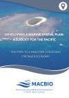
Providing the ten steps to a healthier ocean…
This toolkit outlines the basic process of developing a national marine spatial plan. It has been tailored specifically for use by Pacific Island countries based upon lessons learned in Fiji, Solomon Islands, Tonga and Vanuatu.
Data and Resource
| Field | Value |
|---|---|
| Publisher | Secretariat of the Pacific Regional Environment Programme |
| Modified | |
| Release Date | |
| Source URL | http://www.macbio-pacific.info/ |
| Identifier | 4d2d41c8-a414-4647-aac4-114500e9e0f1 |
| Spatial / Geographical Coverage Location | Pacific Region |
| Relevant Countries | Pacific Region |
| Language | English |
| License |
Public
![[Open Data]](https://assets.okfn.org/images/ok_buttons/od_80x15_blue.png)
|
| Contact Name | pacific@dmin |
| POD Theme | Coastal and Marine |

